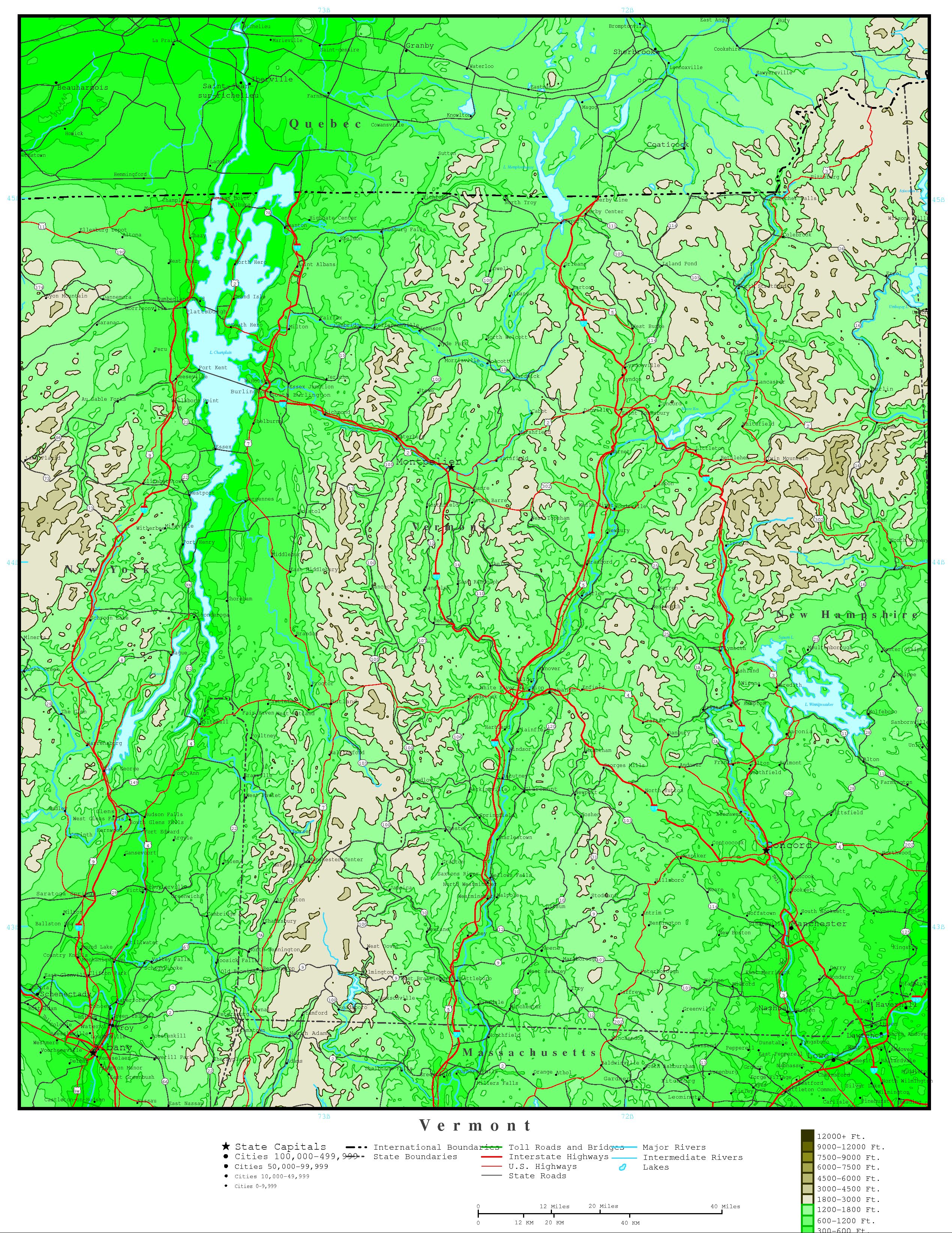
Elevation contour Map of Vermont

Contour map showing interstates and major cities of Vermont state.
To zoom in, hover over the Elevation contour Map of VT State
Download Vermont Elevation Map
Original high-resolution image: Elevation Vermont Map
Elevation Vermont Map
This elevation map of Vermont is free and available for download. You can print this contour map and use it in your projects. The original source of this Elevation contour Map of Vermont is: YellowMaps.com. This large map is a static image in jpg format. You can save it as an image by clicking on the color map to access the original Vermont Elevation Map file. The map covers the following area: state, Vermont, showing major cities and interstates of Vermont.