
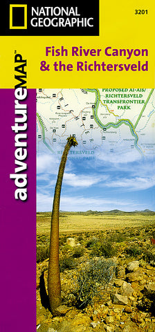
Fish River Canyon and the Richtersveld Adventure Map 3201 by National Geographic Maps
• Waterproof • Tear-Resistant • Travel Map
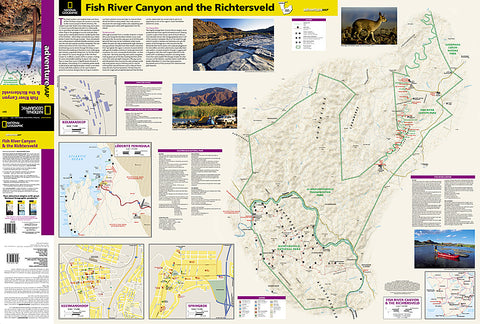
National Geographics Fish River Canyon and the Richtersveld Adventure Map is a complete travel guide for adventure travelers exploring these unique areas in southern Africa. This expertly researched map delivers unparalleled content, unlike any traditional road map. The maps front side has extensive detail of the area, including topographic information, a detailed road network with distances, including 4x4 routes, hiking trails and pinpointed campsites, chalets, visitor centers and scenic viewpoints. Also included are overviews of Richtersveld National Park and Fish River Canyon and information about each ones trail system. In addition, there is a regional map of Luderitz Peninsula and local maps for Kolmanskop, Keetmanshoop and Springbok.
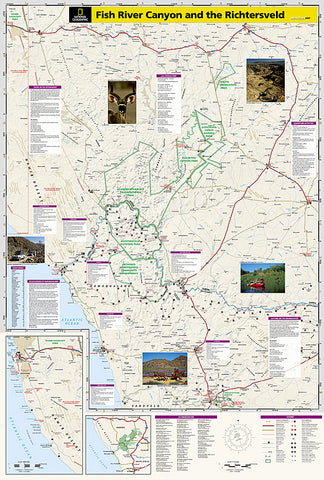
The reverse side covers the entire region, from Springbok in South Africa to Aus in Namibia, with descriptions of many points of interest. Included in this area are the Orange River, Gondwana Canyon Nature Park, Naute Recreation Area and the Sperrgebiet. This broader map has a index of towns and a travel network of roads with distances, including secondary and 4x4 routes, along with border crossings, railway lines and landing strips. Cultural, historical, ecological and recreational points of interest are clearly labeled, including many hidden gems.
Every Adventure Map is printed on durable synthetic paper, making them waterproof, tear-resistant and tough - capable of withstanding the rigors of international travel.
Map Scale = 1:476,000
- Product Number: 2050620M
- Product Code: NG_AM_FISH_RIV
- Publisher Product ID: AD00003201
- ISBN: 9781566951661
- Year of Publication: 2004
- Folded Size: 9.45 x 4.33 inches
- Unfolded Size: 31.89 x 24.8 inches
- Map type: Folded Map
- Geographical region: Namibia


