
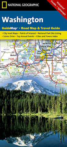
Washington GuideMap by National Geographic Maps
• Waterproof • Tear-Resistant • Travel Map
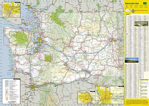
Up-to-date, detailed road map and travel guide to Washington State. The main map features Washingtons highways, toll roads, rest areas, interstates, major and minor cities, National Parks, state parks, points of interest, ski areas, and more. Detailed inset maps of Seattle-Tacoma, downtown Seattle, Olympia, Spokane, and Yakima highlight local roads, points of interest, and local infrastructure. For handy reference, all cities and counties are cross-referenced to an index and a driving distances chart is provided for Washingtons 18 largest cities.
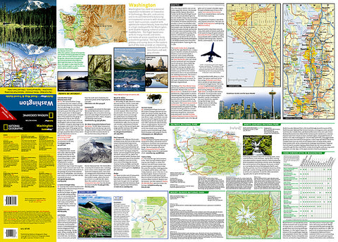
On the reverse, travelers will find descriptions of suggested points-of-interest indexed to the main map, a recommended scenic drive along Mount Adams, maps and useful information on Mount Rainier, Olympic, and North Cascades National Parks, and recommended places to visit in Seattle. An events calendar, climate information, and State facts round out the perfect combination of map and guide.
All National Geographic Guide Maps are printed on durable, waterproof, tear-resistant, environmentally friendly material. Guide Maps are lightweight and folded, making them easier to travel with than large guide books.
Map Scale = 1:1,267,000
- Product Number: 2036603M
- Product Code: NG_GM_WA
- Publisher Product ID: GM01020481
- ISBN: 9781597753135
- Year of Publication: 2015
- Folded Size: 9.06 x 4.33 inches
- Unfolded Size: 17.72 x 20.47 inches
- Map type: Folded Map
- Geographical region: Washington


