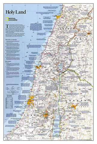
Holy Land, Sleeved by National Geographic Maps
Click to Zoom (high resolution)
National Geographics Holy Land wall map provides a fascinating in-depth look at the faiths, peoples, and politics that have shaped this historic region. This detailed political map is overlayed with facts about significant religious sites. Information on Judaism, Christianity, and Islam, as well as historical periods from the Stone and Bronze ages to the Islamic period through 1917 make this as much an educational tool as an attractive work of cartographic art. Cities, bodies of water, geographical features, ruins, Israeli settlements, and more are noted, as are transportation infrastructure such as highways, roads, railroads, canals, and airports. Coverage includes Lebanon, Syria, Jordan, and Israel.
- Product Number: 2165580M
- Product Code: NG_HOLYLAND_WA_S
- Publisher Product ID: RE0620044F
- ISBN: 9780792293088
- Year of Publication: 2003
- Unfolded Size: 31.5 x 20.67 inches
- Map type: Wall Map
- Geographical region: Asia