
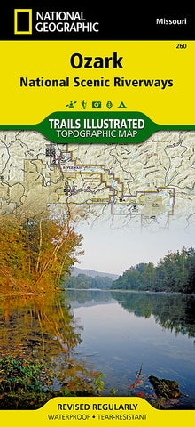
Ozark National Scenic Riverways, Map 260 by National Geographic Maps
• Waterproof • Tear-Resistant • Topographic Map
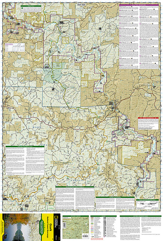
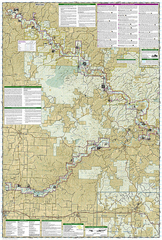
A comprehensive, two-sided topographic map of the Ozark National Scenic Riverways. Includes comprehensive river and trail mileages, campsite and recreational points-of-interest, and trail descriptions for the Ozark Trail, Pioneer Forest Lands, Montauk State Park, and State Conversation Areas. Insets provide information on local hunting, fishing, ATV, equistrian, and spelunking regulations. Printed on 100% plastic material which is waterproof and tear-resistant, ideal for backpacking or river trips. Map includes UTM, Lat/Lon grids, and declination information for use with GPS or compass.
Published with the assistance of Eastern National, a nonprofit association that supports Ozark National Scenic Riverways interpretive program through the sales of books and other materials.
- Product Number: 2036585M
- Product Code: TI_OZARK
- Publisher Product ID: TI00000260
- ISBN: 9781566953597
- Year of Publication: 2007
- Folded Size: 9.45 x 4.33 inches
- Unfolded Size: 37.01 x 24.8 inches
- Map type: Folded Map
- Geographical region: United States


