
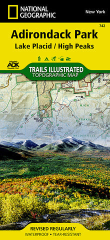
Lake Placid and High Peaks, Adirondack Park, Map 742 by National Geographic Maps
• Waterproof • Tear-Resistant • Topographic Map
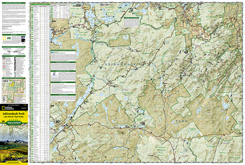
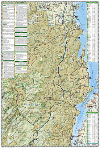
National Geographics Trails Illustrated map of Adirondack Park Lake Placid/High Peaks is a two-sided, waterproof, topographic trail map designed to meet the needs of outdoor enthusiasts with extensive durability and detail. Discover the Adirondacks wild, rugged, and beautiful terrain with the maps detailed elevation contours, shaded relief, vegetation, and water features. This map was created in cooperation with the Adirondack Mountain Club and is loaded with valuable recreation information for all seasons. Trails and major roads are clearly distinguished, along with canoe access and ski areas. Places of interest, including natural features, popular landmarks, and infrastructure are clearly labeled and boundaries for park lands, wilderness, primitive, forest, and protected areas are color coded and easy to discern.
Map coverage includes Saranac Lake Islands and Forest, Blue Mountain Wild Forest, High Peaks Wilderness, Vanderwhacker Mountain Wild Forest, Sentinel Range Wilderness, Dix Mountain Wilderness, and Hoffman Notch Wilderness. The east side, bordered by Lake Champlain, shows Clinton State Forest, Jay Mountain Wilderness, Hurricane Mountain Wilderness, and Hammond Pond Wild Forest.
The Adirondack Park Lake Placid/High Peaks map is designed and printed in the United States on durable synthetic paper, making it waterproof, tear-resistant, and trail tough - made to head outside and go anywhere you do.
- Product Number: 2130069M
- Product Code: TI_NY_742
- Publisher Product ID: TI00000742
- ISBN: 9781566953573
- Year of Publication: 2012
- Folded Size: 9.45 x 4.33 inches
- Unfolded Size: 37.01 x 24.8 inches
- Map type: Folded Map
- Geographical region: New York


