
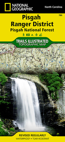
Pisgah Ranger District and Pisgah National Forest, Map 780 by National Geographic Maps
• Waterproof • Tear-Resistant • Topographic Map
Home of the first school of forestry and containing two of the first designated wilderness areas in the eastern United States, Pisgah National Forest is a remarkable land of hardwood forests, mile-high peaks, whitewater rivers, and cascading waterfalls. National Geographics Trails Illustrated map of Pisgah Ranger District, Pisgah National Forest delivers extensive detail and valuable information to assist you in your exploration of this breathtaking wilderness that spans over 500,000 acres. Expertly researched and created in partnership with local land management agencies, this map features key points of interest including Shining Rock and Middle Prong wilderness areas, North Carolina Arboretum, Cradle of Forestry in America National Historic Site, Blue Ridge Parkway, Cold Mountain, and more.
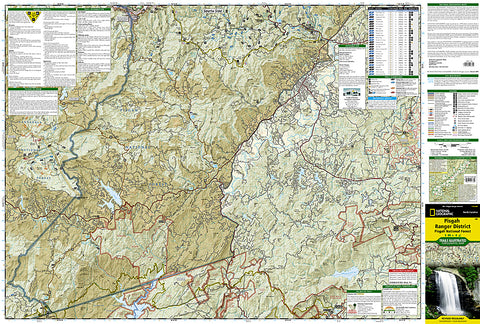
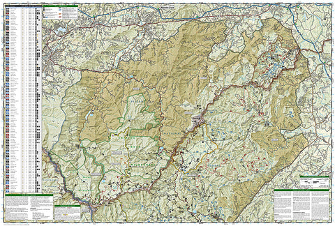
The Forest Service and North Carolina scenic byways are noted for those wishing to take in the scenery by car. Hundreds of miles of trails, including the Mountains-to-Sea, Art Loeb, Palmetto, and Foothills trails are clearly marked and the map base includes contour lines and elevations. A trail chart with locations, mileage, difficulty ratings and designated use will help you choose a trail thats right for your activity level and interest, whether youre hiking, horseback riding, or mountain biking. Many recreation features are noted as well, including campgrounds, trailheads, river access, waterfalls, scenic viewpoints, and horse rental locations.
Every Trails Illustrated map is printed on Backcountry Tough waterproof, tear-resistant paper. A full UTM grid is printed on the map to aid with GPS navigation.
- Product Number: 2034604M
- Product Code: TI_PISGAH
- Publisher Product ID: TI00000780
- ISBN: 9781566953320
- Year of Publication: 2009
- Folded Size: 9.45 x 4.33 inches
- Unfolded Size: 24.8 x 33.07 inches
- Map type: Folded Map
- Geographical region: North Carolina


