New Braunfels Topo Map Texas
To zoom in, hover over the map of New Braunfels
USGS Topo Map 29098e1 - 1:100,000 scale
| Topo Map Name: | New Braunfels |
| USGS Topo Quad ID: | 29098e1 |
| Print Size: | ca. 39" wide x 24" high |
| Southeast Coordinates: | 29.5° N latitude / 98° W longitude |
| Map Center Coordinates: | 29.75° N latitude / 98.5° W longitude |
| U.S. State: | TX |
| Filename: | 29098e1.jpg |
| Download Map JPG Image: | New Braunfels topo map 1:100,000 scale |
| Map Type: | Topographic |
| Topo Series: | 30´x60´ |
| Map Scale: | 1:100,000 |
| Source of Map Images: | United States Geological Survey (USGS) |
| Alternate Map Versions: |
New Braunfels TX 1985, updated 1985 Download PDF Buy paper map New Braunfels TX 1992, updated 1992 Download PDF Buy paper map New Braunfels TX 1992, updated 1992 Download PDF Buy paper map |
1:100,000 Topos surrounding New Braunfels
Kerrville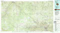 |
Pedernales River |
Austin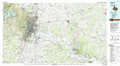 |
Bandera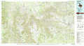 |
New Braunfels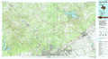 |
Seguin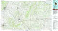 |
Uvalde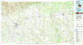 |
San Antonio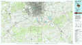 |
Cuero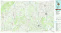 |
> Back to 29098a1 at 1:250,000 scale
> Back to U.S. Topo Maps home
1:24,000 Topo Quads covered by the spatial extent of this 100k map (New Braunfels)
|
Comfort 
|
Waring 
|
Sisterdale 
|
Kendalia 
|
Spring Branch 
|
Fischer 
|
Devils Backbone 
|
Wimberley 
|
|
Turkey Knob 
|
Ranger Creek 
|
Boerne 
|
Bergheim 
|
Anhalt 
|
Smithson Valley 
|
Sattler 
|
Hunter 
|
|
Pipe Creek 
|
Jack Mountain 
|
Van Raub 
|
Camp Bullis 
|
Bulverde 
|
Bat Cave 
|
New Braunfels West 
|
New Braunfels East 
|
|
Medina Lake 
|
San Geronimo 
|
Helotes 
|
Castle Hills 
|
Longhorn 
|
Schertz 
|
Marion 
|
Mcqueeney 
|
