Woodville Topo Map Mississippi
To zoom in, hover over the map of Woodville
USGS Topo Map 31091a1 - 1:100,000 scale
| Topo Map Name: | Woodville |
| USGS Topo Quad ID: | 31091a1 |
| Print Size: | ca. 39" wide x 24" high |
| Southeast Coordinates: | 31° N latitude / 91° W longitude |
| Map Center Coordinates: | 31.25° N latitude / 91.5° W longitude |
| U.S. States: | MS, LA |
| Filename: | 31091a1.jpg |
| Download Map JPG Image: | Woodville topo map 1:100,000 scale |
| Map Type: | Topographic |
| Topo Series: | 30´x60´ |
| Map Scale: | 1:100,000 |
| Source of Map Images: | United States Geological Survey (USGS) |
| Alternate Map Versions: |
Woodville MS 1984, updated 1984 Download PDF Buy paper map Woodville MS 1991, updated 1991 Download PDF Buy paper map |
1:100,000 Topos surrounding Woodville
Winnfield |
Natchez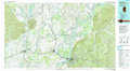 |
Brookhaven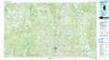 |
Alexandria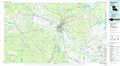 |
Woodville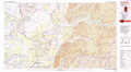 |
Mc Comb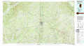 |
Ville Platte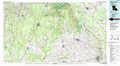 |
New Roads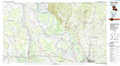 |
Amite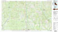 |
> Back to 31090a1 at 1:250,000 scale
> Back to U.S. Topo Maps home
1:24,000 Topo Quads covered by the spatial extent of this 100k map (Woodville)
|
Larto Lake North 
|
Mayna 
|
Monterey 
|
Deer Park 
|
Sibley 
|
Kingston 
|
Jeannette 
|
Knoxville 
|
|
Larto Lake South 
|
Acme 
|
Slocum 
|
Fairview 
|
Buck Island 
|
Doloroso 
|
Garden City 
|
Crosby 
|
|
Lac Sainte Agnes 
|
Ile Natchitoches 
|
Shaw 
|
Lake Mary 
|
Lessley 
|
Laneheart 
|
Wilkinson 
|
Gloster 
|
|
Moreauville 
|
Big Bend 
|
Turnbull Island 
|
Fort Adams 
|
Pinckneyville 
|
Woodville 
|
Newtonia 
|
Centreville 
|
