Nacogdoches Topo Map Texas
To zoom in, hover over the map of Nacogdoches
USGS Topo Map 31094e1 - 1:100,000 scale
| Topo Map Name: | Nacogdoches |
| USGS Topo Quad ID: | 31094e1 |
| Print Size: | ca. 39" wide x 24" high |
| Southeast Coordinates: | 31.5° N latitude / 94° W longitude |
| Map Center Coordinates: | 31.75° N latitude / 94.5° W longitude |
| U.S. States: | TX, LA |
| Filename: | 31094e1.jpg |
| Download Map JPG Image: | Nacogdoches topo map 1:100,000 scale |
| Map Type: | Topographic |
| Topo Series: | 30´x60´ |
| Map Scale: | 1:100,000 |
| Source of Map Images: | United States Geological Survey (USGS) |
| Alternate Map Versions: |
Nacogdoches TX 1986, updated 1986 Download PDF Buy paper map Nacogdoches TX 1992, updated 1992 Download PDF Buy paper map |
1:100,000 Topos surrounding Nacogdoches
Tyler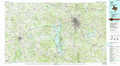 |
Henderson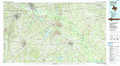 |
Shreveport South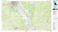 |
Palestine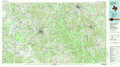 |
Nacogdoches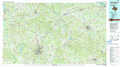 |
Natchitoches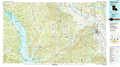 |
Crockett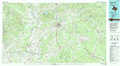 |
Lufkin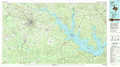 |
Leesville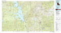 |
> Back to 31094a1 at 1:250,000 scale
> Back to U.S. Topo Maps home
1:24,000 Topo Quads covered by the spatial extent of this 100k map (Nacogdoches)
|
New Salem 
|
Laneville 
|
Mount Enterprise 
|
Caledonia 
|
Timpson 
|
Tenaha West 
|
Tenaha East 
|
Logansport West 
|
|
Reklaw 
|
Cushing 
|
Trawick 
|
Garrison West 
|
Garrison East 
|
Arcadia 
|
Center 
|
Shelbyville 
|
|
Douglas 
|
Lake Nacogdoches North 
|
Nacogdoches North 
|
Appleby 
|
Martinsville 
|
Mount Herman 
|
Neuville 
|
Hurstown 
|
|
Durst Lakes 
|
Lake Nacogdoches South 
|
Nacogdoches South 
|
Woden 
|
Melrose 
|
Chireno North 
|
San Augustine West 
|
San Augustine East 
|
