Mexia Topo Map Texas
To zoom in, hover over the map of Mexia
USGS Topo Map 31096e1 - 1:100,000 scale
| Topo Map Name: | Mexia |
| USGS Topo Quad ID: | 31096e1 |
| Print Size: | ca. 39" wide x 24" high |
| Southeast Coordinates: | 31.5° N latitude / 96° W longitude |
| Map Center Coordinates: | 31.75° N latitude / 96.5° W longitude |
| U.S. State: | TX |
| Filename: | 31096e1.jpg |
| Download Map JPG Image: | Mexia topo map 1:100,000 scale |
| Map Type: | Topographic |
| Topo Series: | 30´x60´ |
| Map Scale: | 1:100,000 |
| Source of Map Images: | United States Geological Survey (USGS) |
| Alternate Map Versions: |
Mexia TX 1985, updated 1985 Download PDF Buy paper map Mexia TX 1985, updated 1992 Download PDF Buy paper map |
1:100,000 Topos surrounding Mexia
Cleburne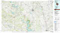 |
Corsicana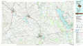 |
Tyler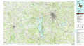 |
Waco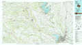 |
Mexia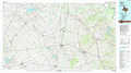 |
Palestine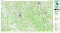 |
Temple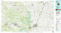 |
Marlin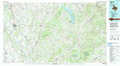 |
Crockett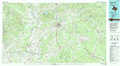 |
> Back to 31096a1 at 1:250,000 scale
> Back to U.S. Topo Maps home
1:24,000 Topo Quads covered by the spatial extent of this 100k map (Mexia)
|
Malone 
|
Irene 
|
Dawson 
|
Purdon 
|
Richland 
|
Streetman 
|
Winkler 
|
Roustabout Camp 
|
|
Penelope 
|
Hubbard 
|
Coolidge 
|
Union High 
|
Wortham 
|
Kirvin 
|
Stewards Mill 
|
Young 
|
|
Axtell 
|
Prairie Hill 
|
Echols 
|
Tehuacana 
|
Mexia 
|
Teague North 
|
Fairfield 
|
Turlington 
|
|
Elk 
|
Mart 
|
Ben Hur 
|
Groesbeck 
|
Fallon 
|
Teague South 
|
Dew 
|
Lanely 
|
