Big Lake Topo Map Texas
To zoom in, hover over the map of Big Lake
USGS Topo Map 31101a1 - 1:100,000 scale
| Topo Map Name: | Big Lake |
| USGS Topo Quad ID: | 31101a1 |
| Print Size: | ca. 39" wide x 24" high |
| Southeast Coordinates: | 31° N latitude / 101° W longitude |
| Map Center Coordinates: | 31.25° N latitude / 101.5° W longitude |
| U.S. State: | TX |
| Filename: | 31101a1.jpg |
| Download Map JPG Image: | Big Lake topo map 1:100,000 scale |
| Map Type: | Topographic |
| Topo Series: | 30´x60´ |
| Map Scale: | 1:100,000 |
| Source of Map Images: | United States Geological Survey (USGS) |
| Alternate Map Versions: |
Big Lake TX 1986, updated 1993 Download PDF Buy paper map |
1:100,000 Topos surrounding Big Lake
Odessa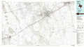 |
Lacy Creek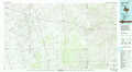 |
Robert Lee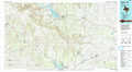 |
Crane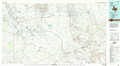 |
Big Lake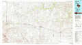 |
San Angelo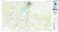 |
Fort Stockton |
Ozona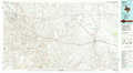 |
Sonora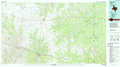 |
> Back to 31100a1 at 1:250,000 scale
> Back to U.S. Topo Maps home
1:24,000 Topo Quads covered by the spatial extent of this 100k map (Big Lake)
|
Lindsey Ranch 
|
Sevenmile Corner Ne 
|
Stiles Nw 
|
Stiles 
|
Moore Hill 
|
South Mustang Draw Ne 
|
Causey Draw 
|
Bradford Draw 
|
|
Sevenmile Corner 
|
Sevenmile Corner Se 
|
Garrison Draw 
|
Gardener Draw 
|
Divide Draw 
|
South Mustang Draw Se 
|
Rocker B Ranch 
|
Ketchum Mountain 
|
|
Rankin 
|
Rankin Ne 
|
Texon 
|
Best 
|
Big Lake 
|
Witco 
|
Barnhart 
|
Barnhart Ne 
|
|
Cedar Canyon 
|
Rankin Se 
|
Lone Mountain 
|
Texon Se 
|
Big Lake Sw 
|
Big Lake Se 
|
Barnhart Sw 
|
Suggs 
|
