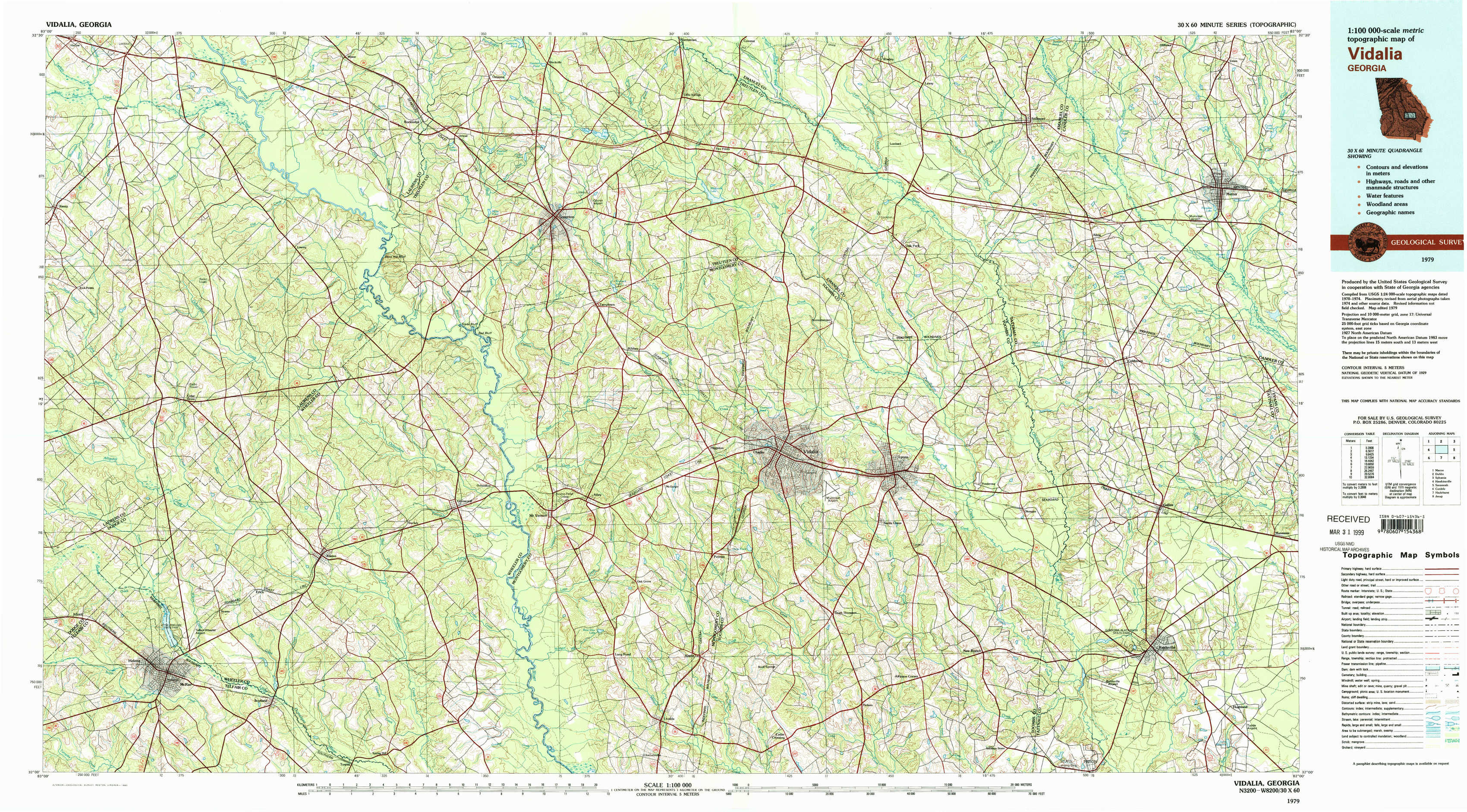
Vidalia Topo Map Georgia
To zoom in, hover over the map of Vidalia
USGS Topo Map 32082a1 - 1:100,000 scale
| Topo Map Name: | Vidalia |
| USGS Topo Quad ID: | 32082a1 |
| Print Size: | ca. 39" wide x 24" high |
| Southeast Coordinates: | 32° N latitude / 82° W longitude |
| Map Center Coordinates: | 32.25° N latitude / 82.5° W longitude |
| U.S. State: | GA |
| Filename: | 32082a1.jpg |
| Download Map JPG Image: | Vidalia topo map 1:100,000 scale |
| Map Type: | Topographic |
| Topo Series: | 30´x60´ |
| Map Scale: | 1:100,000 |
| Source of Map Images: | United States Geological Survey (USGS) |
| Alternate Map Versions: |
Vidalia GA 1979, updated 1980 Download PDF Buy paper map |
1:100,000 Topos surrounding Vidalia
Macon |
Dublin |
Sylvania |
Hawkinsville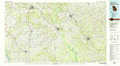 |
Vidalia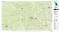 |
Savannah |
Cordele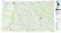 |
Hazlehurst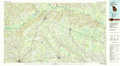 |
Jesup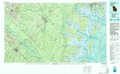 |
> Back to 32082a1 at 1:250,000 scale
> Back to U.S. Topo Maps home
1:24,000 Topo Quads covered by the spatial extent of this 100k map (Vidalia)
|
Rentz 
|
Minter 
|
Rockledge 
|
Soperton North 
|
Covena 
|
Nunez 
|
Stillmore 
|
Metter 
|
|
Five Points 
|
Lowery 
|
Lothair 
|
Soperton South 
|
Oak Park Sw 
|
Oak Park 
|
Cobbtown 
|
Metter Se 
|
|
Mcrae Nw 
|
Alamo 
|
Glenwood 
|
Mount Vernon 
|
Vidalia 
|
Lyons 
|
Ohoopee 
|
Collins 
|
|
Mcrae 
|
Scotland 
|
Jordan 
|
Uvalda 
|
Alston 
|
Johnson Corner 
|
Reidsville West 
|
Reidsville East 
|