Jal Topo Map New Mexico
To zoom in, hover over the map of Jal
USGS Topo Map 32103a1 - 1:100,000 scale
| Topo Map Name: | Jal |
| USGS Topo Quad ID: | 32103a1 |
| Print Size: | ca. 39" wide x 24" high |
| Southeast Coordinates: | 32° N latitude / 103° W longitude |
| Map Center Coordinates: | 32.25° N latitude / 103.5° W longitude |
| U.S. States: | NM, TX |
| Filename: | 32103a1.jpg |
| Download Map JPG Image: | Jal topo map 1:100,000 scale |
| Map Type: | Topographic |
| Topo Series: | 30´x60´ |
| Map Scale: | 1:100,000 |
| Source of Map Images: | United States Geological Survey (USGS) |
| Alternate Map Versions: |
Jal NM 1978, updated 1979 Download PDF Buy paper map |
1:100,000 Topos surrounding Jal
Artesia |
Hobbs |
Seminole |
Carlsbad |
Jal |
Andrews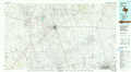 |
Guadalupe Peak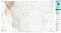 |
Kermit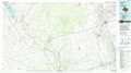 |
Odessa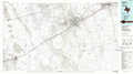 |
> Back to 32102a1 at 1:250,000 scale
> Back to U.S. Topo Maps home
1:24,000 Topo Quads covered by the spatial extent of this 100k map (Jal)
|
Tower Hill South 
|
Livingston Ridge 
|
The Divide 
|
Grama Ridge 
|
San Simon Ranch 
|
Oil Center 
|
Eunice 
|
Eunice Ne 
|
|
Remuda Basin 
|
Los Medanos 
|
Bootleg Ridge 
|
Tip Top Wells 
|
San Simon Sink 
|
East Lake 
|
Rattlesnake Canyon 
|
Eunice Se 
|
|
Pierce Canyon 
|
Big Sinks 
|
Paduca Breaks Nw 
|
Bell Lake 
|
Woodley Flat 
|
Custer Mountain 
|
Jal Nw 
|
Jal Ne 
|
|
Ross Ranch 
|
Phatom Banks 
|
Paduca Breaks West 
|
Paduca Breaks East 
|
Andrews Place 
|
Javelina Basin 
|
Jal 
|
Jal Se 
|
