El Cajon Topo Map California
To zoom in, hover over the map of El Cajon
USGS Topo Map 32116e1 - 1:100,000 scale
| Topo Map Name: | El Cajon |
| USGS Topo Quad ID: | 32116e1 |
| Print Size: | ca. 39" wide x 24" high |
| Southeast Coordinates: | 32.5° N latitude / 116° W longitude |
| Map Center Coordinates: | 32.75° N latitude / 116.5° W longitude |
| U.S. State: | CA |
| Filename: | 32116e1.jpg |
| Download Map JPG Image: | El Cajon topo map 1:100,000 scale |
| Map Type: | Topographic |
| Topo Series: | 30´x60´ |
| Map Scale: | 1:100,000 |
| Source of Map Images: | United States Geological Survey (USGS) |
| Alternate Map Versions: |
El Cajon CA 1979, updated 1979 Download PDF Buy paper map El Cajon CA 1979, updated 1979 Download PDF Buy paper map |
1:100,000 Topos surrounding El Cajon
Oceanside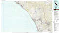 |
Borrego Valley |
Salton Sea |
San Diego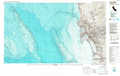 |
El Cajon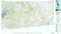 |
El Centro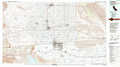 |
> Back to 32116a1 at 1:250,000 scale
> Back to U.S. Topo Maps home
1:24,000 Topo Quads covered by the spatial extent of this 100k map (El Cajon)
|
San Vicente Reservoir 
|
El Cajon Mountain 
|
Tule Springs 
|
Cuyamaca Peak 
|
Monument Peak 
|
Agua Caliente Springs 
|
Arroyo Tapiado 
|
Carrizo Mountain Ne 
|
|
El Cajon 
|
Alpine 
|
Viejas Mountain 
|
Descanso 
|
Mount Laguna 
|
Sombrero Peak 
|
Sweeney Pass 
|
Carrizo Mountain 
|
|
Jamul Mountains 
|
Dulzura 
|
Barrett Lake 
|
Morena Reservoir 
|
Cameron Corners 
|
Live Oak Springs 
|
Jacumba 
|
In-Ko-Pah Gorge 
|
|
Otay Mesa 
|
Otay Mountain 
|
Tecate 
|
Potrero 
|
Campo 
|
Tierra Del Sol 
|
