Lake Kemp Topo Map Texas
To zoom in, hover over the map of Lake Kemp
USGS Topo Map 33099e1 - 1:100,000 scale
| Topo Map Name: | Lake Kemp |
| USGS Topo Quad ID: | 33099e1 |
| Print Size: | ca. 39" wide x 24" high |
| Southeast Coordinates: | 33.5° N latitude / 99° W longitude |
| Map Center Coordinates: | 33.75° N latitude / 99.5° W longitude |
| U.S. State: | TX |
| Filename: | 33099e1.jpg |
| Download Map JPG Image: | Lake Kemp topo map 1:100,000 scale |
| Map Type: | Topographic |
| Topo Series: | 30´x60´ |
| Map Scale: | 1:100,000 |
| Source of Map Images: | United States Geological Survey (USGS) |
| Alternate Map Versions: |
Lake Kemp TX 1985, updated 1985 Download PDF Buy paper map Lake Kemp TX 1985, updated 1994 Download PDF Buy paper map |
1:100,000 Topos surrounding Lake Kemp
Childress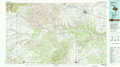 |
Vernon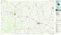 |
Burkburnett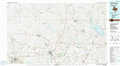 |
Dickens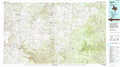 |
Lake Kemp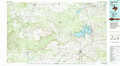 |
Wichita Falls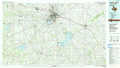 |
Aspermont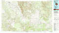 |
Haskell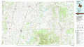 |
Graham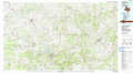 |
> Back to 33098a1 at 1:250,000 scale
> Back to U.S. Topo Maps home
1:24,000 Topo Quads covered by the spatial extent of this 100k map (Lake Kemp)
|
Boiling Spring 
|
Foard City 
|
Crowell 
|
Thalia 
|
Santa Rosa Lake Nw 
|
Santa Rosa Lake 
|
Grayback 
|
Lake Electra 
|
|
Big Four Ranch 
|
Truscott North 
|
Halsell Ranch 
|
Colwell Creek 
|
Santa Rosa Lake Sw 
|
Northwest Lake Kemp 
|
Northeast Lake Kemp 
|
Franklin Bend 
|
|
Maverick Flat 
|
Truscott South 
|
Gilliland 
|
Vera 
|
Soap Creek 
|
Southwest Lake Kemp 
|
Southeast Lake Kemp 
|
Fulda 
|
|
Cedar Mountain 
|
Benjamin 
|
Rhineland 
|
Hefner 
|
Bomarton 
|
Seymour West 
|
Seymour East 
|
Cope Branch 
|
