Newberry Topo Map South Carolina
To zoom in, hover over the map of Newberry
USGS Topo Map 34081a1 - 1:100,000 scale
| Topo Map Name: | Newberry |
| USGS Topo Quad ID: | 34081a1 |
| Print Size: | ca. 39" wide x 24" high |
| Southeast Coordinates: | 34° N latitude / 81° W longitude |
| Map Center Coordinates: | 34.25° N latitude / 81.5° W longitude |
| U.S. State: | SC |
| Filename: | 34081a1.jpg |
| Download Map JPG Image: | Newberry topo map 1:100,000 scale |
| Map Type: | Topographic |
| Topo Series: | 30´x60´ |
| Map Scale: | 1:100,000 |
| Source of Map Images: | United States Geological Survey (USGS) |
| Alternate Map Versions: |
Newberry SC 1986, updated 1986 Download PDF Buy paper map Newberry SC 1986, updated 1989 Download PDF Buy paper map |
1:100,000 Topos surrounding Newberry
Greenville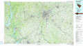 |
Spartanburg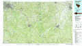 |
Lancaster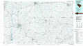 |
Abbeville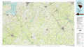 |
Newberry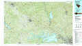 |
Camden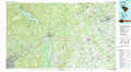 |
Clark Hill Lake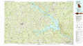 |
Aiken |
Sumter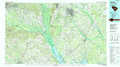 |
> Back to 34080a1 at 1:250,000 scale
> Back to U.S. Topo Maps home
1:24,000 Topo Quads covered by the spatial extent of this 100k map (Newberry)
|
Clinton 
|
Joanna 
|
Newberry Nw 
|
Whitmire South 
|
Blair 
|
Salem Crossroads 
|
Lebanon 
|
Winnsboro 
|
|
Cross Hill 
|
Bush River 
|
Newberry West 
|
Newberry East 
|
Pomaria 
|
Jenkinsville 
|
Rion 
|
Winnsboro Mills 
|
|
Dyson 
|
Chappells 
|
Silverstreet 
|
Prosperity 
|
Little Mountain 
|
Chapin 
|
Richtex 
|
Irmo Ne 
|
|
Good Hope 
|
Saluda North 
|
Denny 
|
Delmar 
|
Lake Murray West 
|
Lake Murray East 
|
Irmo 
|
Columbia North 
|
