Corinth Topo Map Mississippi
To zoom in, hover over the map of Corinth
USGS Topo Map 34088e1 - 1:100,000 scale
| Topo Map Name: | Corinth |
| USGS Topo Quad ID: | 34088e1 |
| Print Size: | ca. 39" wide x 24" high |
| Southeast Coordinates: | 34.5° N latitude / 88° W longitude |
| Map Center Coordinates: | 34.75° N latitude / 88.5° W longitude |
| U.S. States: | MS, AL, TN |
| Filename: | 34088e1.jpg |
| Download Map JPG Image: | Corinth topo map 1:100,000 scale |
| Map Type: | Topographic |
| Topo Series: | 30´x60´ |
| Map Scale: | 1:100,000 |
| Source of Map Images: | United States Geological Survey (USGS) |
| Alternate Map Versions: |
Corinth MS 1984, updated 1984 Download PDF Buy paper map Corinth MS 1994, updated 1994 Download PDF Buy paper map |
1:100,000 Topos surrounding Corinth
Memphis East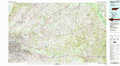 |
Selmer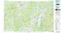 |
Lawrenceburg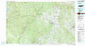 |
Holly Springs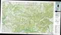 |
Corinth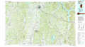 |
Tuscumbia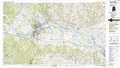 |
Oxford |
Tupelo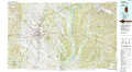 |
Haleyville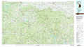 |
> Back to 34088a1 at 1:250,000 scale
> Back to U.S. Topo Maps home
1:24,000 Topo Quads covered by the spatial extent of this 100k map (Corinth)
|
Walnut 
|
Chalybeate 
|
Kossuth North 
|
Corinth 
|
Kendrick 
|
Doskie 
|
Yellow Creek 
|
Waterloo 
|
|
Falkner 
|
Peoples 
|
Kossuth South 
|
Rienzi 
|
Glens 
|
Burnsville 
|
Iuka 
|
Margerum 
|
|
Ripley 
|
Dumas 
|
Jumpertown 
|
Booneville 
|
Altitude 
|
Paden 
|
Tishomingo 
|
Bishop 
|
|
Keownville 
|
Pleasant Ridge 
|
Baldwyn 
|
Wheeler 
|
Marietta 
|
Paden Se 
|
Belmont 
|
Pleasant Site 
|
