Lawton Topo Map Oklahoma
To zoom in, hover over the map of Lawton
USGS Topo Map 34098e1 - 1:100,000 scale
| Topo Map Name: | Lawton |
| USGS Topo Quad ID: | 34098e1 |
| Print Size: | ca. 39" wide x 24" high |
| Southeast Coordinates: | 34.5° N latitude / 98° W longitude |
| Map Center Coordinates: | 34.75° N latitude / 98.5° W longitude |
| U.S. State: | OK |
| Filename: | 34098e1.jpg |
| Download Map JPG Image: | Lawton topo map 1:100,000 scale |
| Map Type: | Topographic |
| Topo Series: | 30´x60´ |
| Map Scale: | 1:100,000 |
| Source of Map Images: | United States Geological Survey (USGS) |
| Alternate Map Versions: |
Lawton OK 1981, updated 1981 Download PDF Buy paper map |
1:100,000 Topos surrounding Lawton
Elk City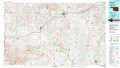 |
Anadarko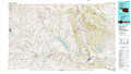 |
Oklahoma City South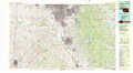 |
Altus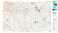 |
Lawton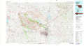 |
Pauls Valley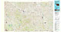 |
Vernon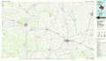 |
Burkburnett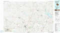 |
Ardmore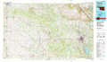 |
> Back to 34098a1 at 1:250,000 scale
> Back to U.S. Topo Maps home
1:24,000 Topo Quads covered by the spatial extent of this 100k map (Lawton)
|
Rainy Mountain Creek 
|
Unap Mountain 
|
Bally Mountain 
|
Alden 
|
Boone 
|
Apache 
|
Cyril 
|
Laverty 
|
|
Glen Mountains 
|
Cooperton 
|
Saddle Mountain 
|
Meers 
|
Richards Spur 
|
Elgin 
|
Fletcher 
|
Rocky Ford 
|
|
Snyder 
|
Odetta 
|
Quanah Mountain 
|
Mount Scott 
|
Fort Sill 
|
Arbuckle Hill 
|
Sterling 
|
Denton 
|
|
Manitou 
|
Indiahoma 
|
Post Oak Creek 
|
Taupa 
|
Lawton 
|
Ninemile Creek 
|
Letitia 
|
Nellie 
|
