Quemado Topo Map New Mexico
To zoom in, hover over the map of Quemado
USGS Topo Map 34108a1 - 1:100,000 scale
| Topo Map Name: | Quemado |
| USGS Topo Quad ID: | 34108a1 |
| Print Size: | ca. 39" wide x 24" high |
| Southeast Coordinates: | 34° N latitude / 108° W longitude |
| Map Center Coordinates: | 34.25° N latitude / 108.5° W longitude |
| U.S. State: | NM |
| Filename: | 34108a1.jpg |
| Download Map JPG Image: | Quemado topo map 1:100,000 scale |
| Map Type: | Topographic |
| Topo Series: | 30´x60´ |
| Map Scale: | 1:100,000 |
| Source of Map Images: | United States Geological Survey (USGS) |
| Alternate Map Versions: |
Quemado NM 1983, updated 1983 Download PDF Buy paper map Quemado NM 1983, updated 1983 Download PDF Buy paper map |
1:100,000 Topos surrounding Quemado
Saint Johns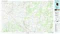 |
Fence Lake |
Acoma Pueblo |
Springerville |
Quemado |
Magdalena |
Nutrioso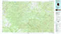 |
Tularosa Mountains |
San Mateo Mountains |
> Back to 34108a1 at 1:250,000 scale
> Back to U.S. Topo Maps home
1:24,000 Topo Quads covered by the spatial extent of this 100k map (Quemado)
|
Salazar Canyon 
|
Zuni Salt Lake 
|
Lake Armijo 
|
Tejana Mesa 
|
Mariano Springs 
|
Adams Diggings 
|
Blue Hills 
|
Tres Lagunas 
|
|
Goat Spring 
|
Blaines Lake 
|
Tejana Mesa Sw 
|
Armstrong Canyon 
|
Quemado 
|
Omega 
|
Pie Town 
|
Red Flats 
|
|
Cow Springs 
|
Red Hill 
|
Pondersoa Tank 
|
Largo Mesa 
|
Escondido Mountains 
|
Mangas 
|
Alegres Mountain 
|
Cox Peak 
|
|
Jones Canyon 
|
Black Peak 
|
Gallo Mountains West 
|
Gallo Mountains East 
|
Slaughter Mesa 
|
Mangas Mountain 
|
Wallace Mesa 
|
Log Canyon 
|
