Show Low Topo Map Arizona
To zoom in, hover over the map of Show Low
USGS Topo Map 34110a1 - 1:100,000 scale
| Topo Map Name: | Show Low |
| USGS Topo Quad ID: | 34110a1 |
| Print Size: | ca. 39" wide x 24" high |
| Southeast Coordinates: | 34° N latitude / 110° W longitude |
| Map Center Coordinates: | 34.25° N latitude / 110.5° W longitude |
| U.S. State: | AZ |
| Filename: | 34110a1.jpg |
| Download Map JPG Image: | Show Low topo map 1:100,000 scale |
| Map Type: | Topographic |
| Topo Series: | 30´x60´ |
| Map Scale: | 1:100,000 |
| Source of Map Images: | United States Geological Survey (USGS) |
| Alternate Map Versions: |
Show Low AZ 1981, updated 1982 Download PDF Buy paper map Show Low AZ 1981, updated 1982 Download PDF Buy paper map |
1:100,000 Topos surrounding Show Low
Sedona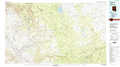 |
Holbrook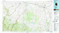 |
Saint Johns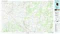 |
Payson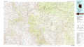 |
Show Low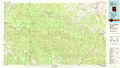 |
Springerville |
Theodore Roosevelt Lake |
Seneca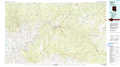 |
Nutrioso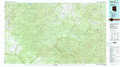 |
> Back to 34110a1 at 1:250,000 scale
> Back to U.S. Topo Maps home
1:24,000 Topo Quads covered by the spatial extent of this 100k map (Show Low)
|
Porcupine Ridge 
|
Weimer Point 
|
Hanks Draw 
|
Heber 
|
Aripine 
|
Big Pug Tank 
|
Cactus Flat 
|
Taylor 
|
|
Woods Canyon 
|
O W Point 
|
Brookbank Point 
|
Outlaw Draw 
|
Day Spring 
|
Clay Springs 
|
Pinedale 
|
Show Low North 
|
|
Oxbow Mountain 
|
Parallel Canyon 
|
Chediski Peak 
|
Pepper Canyon 
|
Bear Ridge 
|
Limestone Canyon North 
|
Red Top Mountain 
|
Show Low South 
|
|
Young 
|
Gentry Mountain 
|
Oak Creek Ranch 
|
Spotted Mountain 
|
Cibecue 
|
Limestone Canyon South 
|
Long Tom Canyon 
|
Faught Ridge 
|
