Enid Topo Map Oklahoma
To zoom in, hover over the map of Enid
USGS Topo Map 36097a1 - 1:100,000 scale
| Topo Map Name: | Enid |
| USGS Topo Quad ID: | 36097a1 |
| Print Size: | ca. 39" wide x 24" high |
| Southeast Coordinates: | 36° N latitude / 97° W longitude |
| Map Center Coordinates: | 36.25° N latitude / 97.5° W longitude |
| U.S. State: | OK |
| Filename: | 36097a1.jpg |
| Download Map JPG Image: | Enid topo map 1:100,000 scale |
| Map Type: | Topographic |
| Topo Series: | 30´x60´ |
| Map Scale: | 1:100,000 |
| Source of Map Images: | United States Geological Survey (USGS) |
| Alternate Map Versions: |
Enid OK 1990, updated 1990 Download PDF Buy paper map |
1:100,000 Topos surrounding Enid
Alva |
Ponca City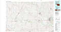 |
Pawhuska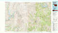 |
Fairview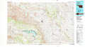 |
Enid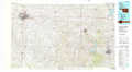 |
Keystone Lake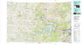 |
Watonga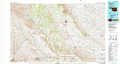 |
Oklahoma City North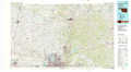 |
Bristow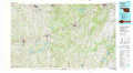 |
> Back to 36096a1 at 1:250,000 scale
> Back to U.S. Topo Maps home
1:24,000 Topo Quads covered by the spatial extent of this 100k map (Enid)
|
Enid West 
|
Enid East 
|
Breckinridge 
|
Garber 
|
Perry Nw 
|
Ceres 
|
Red Rock 
|
Morrison Ne 
|
|
Waukomis 
|
Enid Se 
|
Fairmont 
|
Covington 
|
Lucien 
|
Perry 
|
Black Bear 
|
Morrison 
|
|
Bison 
|
Steinerts Lake 
|
Marshall West 
|
Marshall East 
|
Orlando West 
|
Orlando East 
|
Lake Carl Blackwell 
|
Stillwater North 
|
|
Hennessey 
|
Union 
|
Lovell 
|
Bridge Creek 
|
Mulhall 
|
Clear Creek 
|
Stillwater Sw 
|
Stillwater South 
|
