Farmington Topo Map New Mexico
To zoom in, hover over the map of Farmington
USGS Topo Map 36108e1 - 1:100,000 scale
| Topo Map Name: | Farmington |
| USGS Topo Quad ID: | 36108e1 |
| Print Size: | ca. 39" wide x 24" high |
| Southeast Coordinates: | 36.5° N latitude / 108° W longitude |
| Map Center Coordinates: | 36.75° N latitude / 108.5° W longitude |
| U.S. States: | NM, CO |
| Filename: | 36108e1.jpg |
| Download Map JPG Image: | Farmington topo map 1:100,000 scale |
| Map Type: | Topographic |
| Topo Series: | 30´x60´ |
| Map Scale: | 1:100,000 |
| Source of Map Images: | United States Geological Survey (USGS) |
| Alternate Map Versions: |
Farmington NM 1980, updated 1981 Download PDF Buy paper map Farmington NM 1980, updated 1981 Download PDF Buy paper map |
1:100,000 Topos surrounding Farmington
Bluff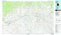 |
Cortez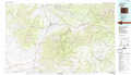 |
Durango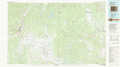 |
Rock Point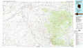 |
Farmington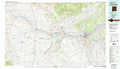 |
Navajo Reservoir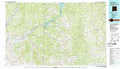 |
Canyon De Chelly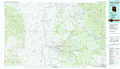 |
Toadlena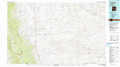 |
Chaco Canyon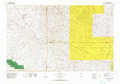 |
> Back to 36108a1 at 1:250,000 scale
> Back to U.S. Topo Maps home
1:24,000 Topo Quads covered by the spatial extent of this 100k map (Farmington)
|
Sallies Spring 
|
Canal Creek 
|
Skinney Rock 
|
Palmer Mesa 
|
Heifer Point 
|
Purgatory Canyon 
|
La Plata 
|
Abode Downs Ranch 
|
|
Rocky Point 
|
Rattlesnake 
|
Shiprock 
|
Chimney Rock 
|
Waterflow 
|
Youngs Lake 
|
Farmington North 
|
Flora Vista 
|
|
Sand Spring 
|
Ship Rock 
|
Sulphur Spring 
|
The Hogack North 
|
Fruitland 
|
Kirtland 
|
Farmington South 
|
Horn Canyon 
|
|
Mitten Rock 
|
Yellow Hill 
|
Table Mesa 
|
The Hogback South 
|
Kirtland Sw 
|
Kirtland Se 
|
Hugh Lake 
|
Gallegos Trading Post 
|
