Glen Canyon Dam Topo Map Arizona
To zoom in, hover over the map of Glen Canyon Dam
USGS Topo Map 36111e1 - 1:100,000 scale
| Topo Map Name: | Glen Canyon Dam |
| USGS Topo Quad ID: | 36111e1 |
| Print Size: | ca. 39" wide x 24" high |
| Southeast Coordinates: | 36.5° N latitude / 111° W longitude |
| Map Center Coordinates: | 36.75° N latitude / 111.5° W longitude |
| U.S. State: | AZ |
| Filename: | 36111e1.jpg |
| Download Map JPG Image: | Glen Canyon Dam topo map 1:100,000 scale |
| Map Type: | Topographic |
| Topo Series: | 30´x60´ |
| Map Scale: | 1:100,000 |
| Source of Map Images: | United States Geological Survey (USGS) |
| Alternate Map Versions: |
Glen Canyon Dam AZ 1984, updated 1984 Download PDF Buy paper map Glen Canyon Dam AZ 1984, updated 1984 Download PDF Buy paper map |
1:100,000 Topos surrounding Glen Canyon Dam
Kanab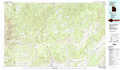 |
Smoky Mountain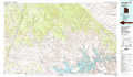 |
Navajo Mountain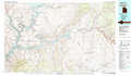 |
Fredonia |
Glen Canyon Dam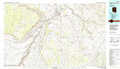 |
Kayenta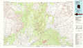 |
Grand Canyon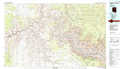 |
Tuba City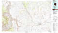 |
Pinon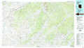 |
> Back to 36110a1 at 1:250,000 scale
> Back to U.S. Topo Maps home
1:24,000 Topo Quads covered by the spatial extent of this 100k map (Glen Canyon Dam)
|
Poverty Flat 
|
Wrather Arch 
|
Water Pockets 
|
Ferry Swale 
|
Page 
|
Wild Horse Mesa 
|
Face Canyon 
|
West Canyon Creek 
|
|
One Toe Ridge 
|
The Big Knoll 
|
Navajo Bridge 
|
Lees Ferry 
|
White Dome 
|
Leche-E Rock 
|
Cedar Tree Bench 
|
Tse Esgizii 
|
|
Emmett Hill 
|
Emmett Wash 
|
Bitter Springs 
|
Explosive Rock 
|
Dead Monkey Ridge 
|
Many Ghosts Hill 
|
Horsethief Mesa 
|
White Hill 
|
|
Buffalo Tanks 
|
North Canyon Point 
|
Tanner Well 
|
Cedar Tree Hills 
|
Dove Spring 
|
Dove Spring Se 
|
Arrowhead Mesa 
|
Kaibito 
|
