Mount Trumbull Topo Map Arizona
To zoom in, hover over the map of Mount Trumbull
USGS Topo Map 36113a1 - 1:100,000 scale
| Topo Map Name: | Mount Trumbull |
| USGS Topo Quad ID: | 36113a1 |
| Print Size: | ca. 39" wide x 24" high |
| Southeast Coordinates: | 36° N latitude / 113° W longitude |
| Map Center Coordinates: | 36.25° N latitude / 113.5° W longitude |
| U.S. State: | AZ |
| Filename: | 36113a1.jpg |
| Download Map JPG Image: | Mount Trumbull topo map 1:100,000 scale |
| Map Type: | Topographic |
| Topo Series: | 30´x60´ |
| Map Scale: | 1:100,000 |
| Source of Map Images: | United States Geological Survey (USGS) |
| Alternate Map Versions: |
Mount Trumbull AZ 1986, updated 1987 Download PDF Buy paper map Mount Trumbull AZ 1986, updated 1987 Download PDF Buy paper map |
1:100,000 Topos surrounding Mount Trumbull
Overton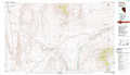 |
Littlefield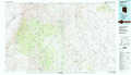 |
Fredonia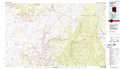 |
Lake Mead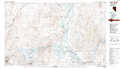 |
Mount Trumbull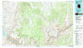 |
Grand Canyon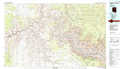 |
Boulder City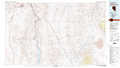 |
Peach Springs |
Valle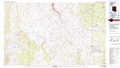 |
> Back to 36112a1 at 1:250,000 scale
> Back to U.S. Topo Maps home
1:24,000 Topo Quads covered by the spatial extent of this 100k map (Mount Trumbull)
|
Pakoon Springs 
|
Olaf Knolls 
|
Last Chance Canyon 
|
Poverty Spring 
|
Poverty Knoll 
|
Jones Hill 
|
Mount Trumbull 
|
Mount Trumbull Ne 
|
|
Gyp Hills 
|
Grand Gulch Bench 
|
Mustang Point 
|
Wildcat Ranch 
|
Grassy Mountain 
|
Cold Spring 
|
Mount Logan 
|
Mount Trumbull Se 
|
|
Snap Canyon West 
|
Snap Canyon East 
|
Snap Draw 
|
Castle Peak 
|
Yellow John Mountain 
|
Whitmore Point 
|
Whitmore Rapids 
|
Vulcans Throne 
|
|
Columbine Falls 
|
Bat Cave 
|
Tincanebitts Point 
|
Mount Dellenbaugh 
|
Whitmore Point Sw 
|
Whitmore Point Se 
|
Vulcans Throne Sw 
|
Vulcans Throne Se 
|
