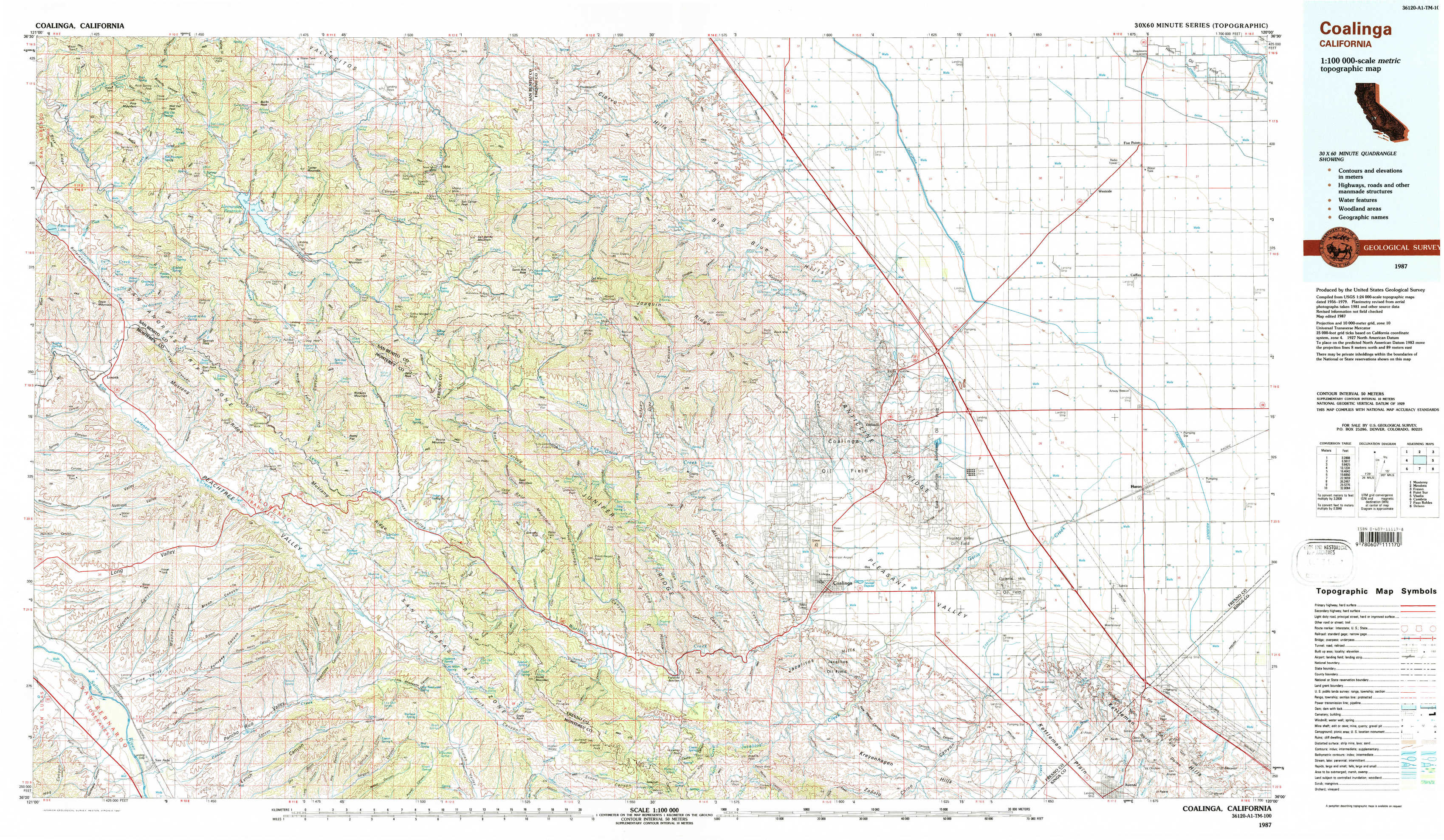
Coalinga Topo Map California
To zoom in, hover over the map of Coalinga
USGS Topo Map 36120a1 - 1:100,000 scale
| Topo Map Name: | Coalinga |
| USGS Topo Quad ID: | 36120a1 |
| Print Size: | ca. 39" wide x 24" high |
| Southeast Coordinates: | 36° N latitude / 120° W longitude |
| Map Center Coordinates: | 36.25° N latitude / 120.5° W longitude |
| U.S. State: | CA |
| Filename: | 36120a1.jpg |
| Download Map JPG Image: | Coalinga topo map 1:100,000 scale |
| Map Type: | Topographic |
| Topo Series: | 30´x60´ |
| Map Scale: | 1:100,000 |
| Source of Map Images: | United States Geological Survey (USGS) |
| Alternate Map Versions: |
Coalinga CA 1987, updated 1987 Download PDF Buy paper map |
1:100,000 Topos surrounding Coalinga
Monterey |
Mendota |
Fresno |
Point Sur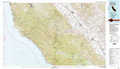 |
Coalinga |
Visalia |
Cambria |
Paso Robles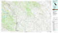 |
Delano |
> Back to 36120a1 at 1:250,000 scale
> Back to U.S. Topo Maps home
1:24,000 Topo Quads covered by the spatial extent of this 100k map (Coalinga)
|
Rock Spring Peak 
|
Hernandez Reservoir 
|
Idria 
|
Ciervo Mountain 
|
Lillis Ranch 
|
Tres Picos Farms 
|
Westside 
|
Five Points 
|
|
Lonoak 
|
Hepsedam Peak 
|
San Benito Mountain 
|
Santa Rita Peak 
|
Joaquin Rocks 
|
Domengine Ranch 
|
Harris Ranch 
|
Calflax 
|
|
Nattrass Valley 
|
Monarch Peak 
|
Priest Valley 
|
Sherman Peak 
|
Alcalde Hills 
|
Coalinga 
|
Guijarral Hills 
|
Huron 
|
|
San Ardo 
|
Pancho Rico Valley 
|
Slack Canyon 
|
Smith Mountain 
|
Curry Mountain 
|
Kreyenhagen Hills 
|
Avenal 
|
La Cima 
|