Mendota Topo Map California
To zoom in, hover over the map of Mendota
USGS Topo Map 36120e1 - 1:100,000 scale
| Topo Map Name: | Mendota |
| USGS Topo Quad ID: | 36120e1 |
| Print Size: | ca. 39" wide x 24" high |
| Southeast Coordinates: | 36.5° N latitude / 120° W longitude |
| Map Center Coordinates: | 36.75° N latitude / 120.5° W longitude |
| U.S. State: | CA |
| Filename: | 36120e1.jpg |
| Download Map JPG Image: | Mendota topo map 1:100,000 scale |
| Map Type: | Topographic |
| Topo Series: | 30´x60´ |
| Map Scale: | 1:100,000 |
| Source of Map Images: | United States Geological Survey (USGS) |
| Alternate Map Versions: |
Mendota CA 1982, updated 1983 Download PDF Buy paper map Mendota CA 1982, updated 1983 Download PDF Buy paper map |
1:100,000 Topos surrounding Mendota
San Jose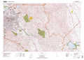 |
Merced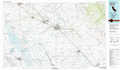 |
Shaver Lake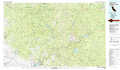 |
Monterey |
Mendota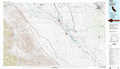 |
Fresno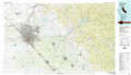 |
Point Sur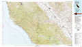 |
Coalinga |
Visalia |
> Back to 36120a1 at 1:250,000 scale
> Back to U.S. Topo Maps home
1:24,000 Topo Quads covered by the spatial extent of this 100k map (Mendota)
|
Ortigalita Peak Nw 
|
Charleston School 
|
Dos Palos 
|
Oxalis 
|
Poso Farm 
|
Firebaugh Ne 
|
Bonita Ranch 
|
Madera 
|
|
Ortigalita Peak 
|
Laguna Seca Ranch 
|
Hammonds Ranch 
|
Broadview Farms 
|
Firebaugh 
|
Mendota Dam 
|
Gravelly Ford 
|
Biola 
|
|
Cerro Colorado 
|
Mercey Hot Springs 
|
Chounet Ranch 
|
Chaney Ranch 
|
Coit Ranch 
|
Tranquillity 
|
Jamesan 
|
Kerman 
|
|
Llanada 
|
Panoche 
|
Tumey Hills 
|
Monocline Ridge 
|
Levis 
|
Cantua Creek 
|
San Joaquin 
|
Helm 
|
