La Junta Topo Map Colorado
To zoom in, hover over the map of La Junta
USGS Topo Map 37103e1 - 1:100,000 scale
| Topo Map Name: | La Junta |
| USGS Topo Quad ID: | 37103e1 |
| Print Size: | ca. 39" wide x 24" high |
| Southeast Coordinates: | 37.5° N latitude / 103° W longitude |
| Map Center Coordinates: | 37.75° N latitude / 103.5° W longitude |
| U.S. State: | CO |
| Filename: | 37103e1.jpg |
| Download Map JPG Image: | La Junta topo map 1:100,000 scale |
| Map Type: | Topographic |
| Topo Series: | 30´x60´ |
| Map Scale: | 1:100,000 |
| Source of Map Images: | United States Geological Survey (USGS) |
| Alternate Map Versions: |
La Junta CO 1982, updated 1983 Download PDF Buy paper map |
1:100,000 Topos surrounding La Junta
Pueblo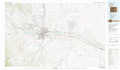 |
Las Animas |
Lamar |
Walsenburg |
La Junta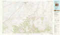 |
Two Buttes Reservoir |
Trinidad |
Kim |
Springfield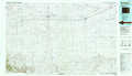 |
> Back to 37102a1 at 1:250,000 scale
> Back to U.S. Topo Maps home
1:24,000 Topo Quads covered by the spatial extent of this 100k map (La Junta)
|
Timpas Nw 
|
Timpas Ne 
|
Hawley 
|
La Junta 
|
Thompson Arroyo 
|
Hackamore Ranch 
|
Gilpin 
|
Toonerville Ne 
|
|
Timpas Sw 
|
Timpas 
|
La Junta Sw 
|
La Junta Se 
|
Higbee 
|
Turkey Canyon 
|
Toonerville 
|
Toonerville Se 
|
|
Bloom 
|
Sheep Canyon 
|
Packers Gap 
|
Riley Canyon 
|
Corbin Canyon 
|
Rock Canyon 
|
Ninaview 
|
Clay Ranch 
|
|
Lockwood Arroyo 
|
Stage Canyon 
|
O V Mesa 
|
Beaty Canyon 
|
Lost Canyon 
|
Brown Canyon 
|
Plug Hat Ranch 
|
Walker Canyon 
|
