Benton Range Topo Map California
To zoom in, hover over the map of Benton Range
USGS Topo Map 37118e1 - 1:100,000 scale
| Topo Map Name: | Benton Range |
| USGS Topo Quad ID: | 37118e1 |
| Print Size: | ca. 39" wide x 24" high |
| Southeast Coordinates: | 37.5° N latitude / 118° W longitude |
| Map Center Coordinates: | 37.75° N latitude / 118.5° W longitude |
| U.S. States: | CA, NV |
| Filename: | 37118e1.jpg |
| Download Map JPG Image: | Benton Range topo map 1:100,000 scale |
| Map Type: | Topographic |
| Topo Series: | 30´x60´ |
| Map Scale: | 1:100,000 |
| Source of Map Images: | United States Geological Survey (USGS) |
| Alternate Map Versions: |
Benton Range CA 1988 Download PDF Buy paper map Benton Range CA 1988, updated 1988 Download PDF Buy paper map |
1:100,000 Topos surrounding Benton Range
Bridgeport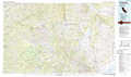 |
Excelsior Mountains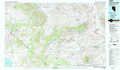 |
Tonopah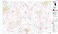 |
Yosemite Valley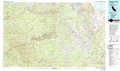 |
Benton Range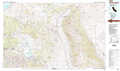 |
Goldfield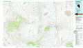 |
Shaver Lake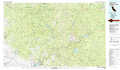 |
Bishop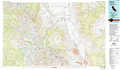 |
Last Chance Range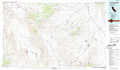 |
> Back to 37118a1 at 1:250,000 scale
> Back to U.S. Topo Maps home
1:24,000 Topo Quads covered by the spatial extent of this 100k map (Benton Range)
|
Mono Mills 
|
Cowtrack Mountain 
|
Indian Meadows 
|
River Spring 
|
Truman Meadows 
|
Mount Montgomery 
|
Volcanic Hills West 
|
Volcanic Hills East 
|
|
Crestview 
|
Dexter Canyon 
|
Glass Mountain 
|
Benton Hot Spirngs 
|
Benton 
|
Boundary Peak 
|
Davis Mountain 
|
East Of Davis Mountain 
|
|
Old Mammoth 
|
Whitmore Hot Springs 
|
Watterson Canyon 
|
Banner Ridge 
|
Hammil Valley 
|
White Mountain Peak 
|
Juniper Mountain 
|
Dyer 
|
|
Bloody Mountain 
|
Convict Lake 
|
Toms Place 
|
Casa Diablo Mountain 
|
Chidago Canyon 
|
Chalfant Valley 
|
Mount Barcroft 
|
Station Peak 
|
