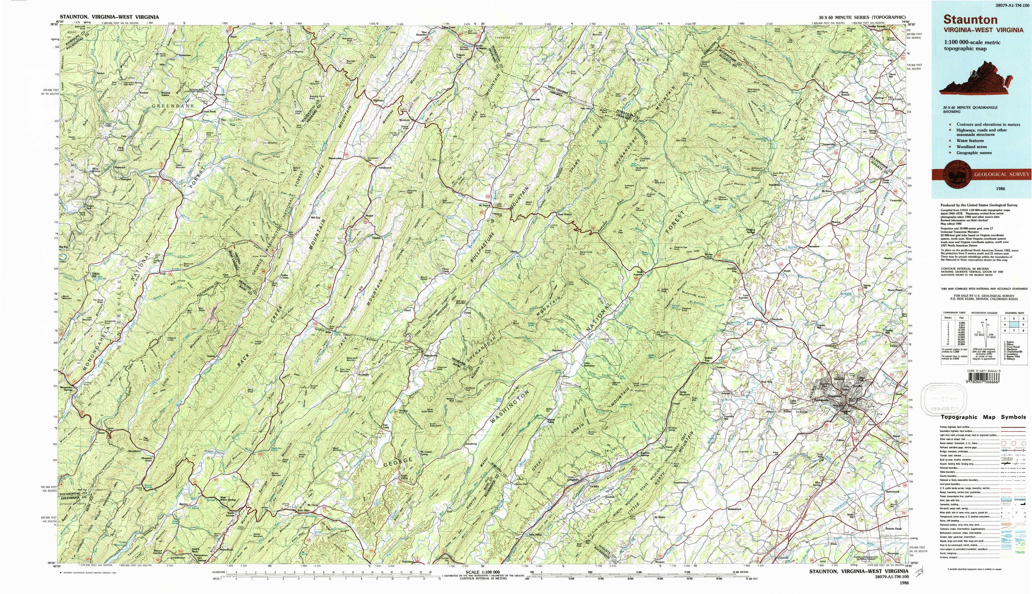
Staunton Topo Map Virginia
To zoom in, hover over the map of Staunton
USGS Topo Map 38079a1 - 1:100,000 scale
| Topo Map Name: | Staunton |
| USGS Topo Quad ID: | 38079a1 |
| Print Size: | ca. 39" wide x 24" high |
| Southeast Coordinates: | 38° N latitude / 79° W longitude |
| Map Center Coordinates: | 38.25° N latitude / 79.5° W longitude |
| U.S. States: | VA, WV |
| Filename: | 38079a1.jpg |
| Download Map JPG Image: | Staunton topo map 1:100,000 scale |
| Map Type: | Topographic |
| Topo Series: | 30´x60´ |
| Map Scale: | 1:100,000 |
| Source of Map Images: | United States Geological Survey (USGS) |
| Alternate Map Versions: |
Staunton VA 1986, updated 1986 Download PDF Buy paper map Staunton VA 1986, updated 1989 Download PDF Buy paper map |
1:100,000 Topos surrounding Staunton
Sutton |
Elkins |
Front Royal |
Marlinton |
Staunton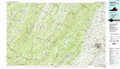 |
Charlottesville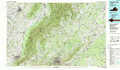 |
Lewisburg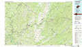 |
Buena Vista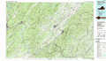 |
Dillwyn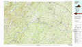 |
> Back to 38078a1 at 1:250,000 scale
> Back to U.S. Topo Maps home
1:24,000 Topo Quads covered by the spatial extent of this 100k map (Staunton)
|
Cass 
|
Green Bank 
|
Hightown 
|
Monterey 
|
Doe Hill 
|
Palo Alto 
|
Reddish Knob 
|
Briery Branch 
|
|
Clover Lick 
|
Paddy Knob 
|
Mustoe 
|
Monterey Se 
|
Mcdowell 
|
West Augusta 
|
Stokesville 
|
Parnassus 
|
|
Minnehaha Springs 
|
Sunrise 
|
Burnsville 
|
Williamsville 
|
Deerfield 
|
Elliott Knob 
|
Churchville 
|
Staunton 
|
|
Mountain Grove 
|
Warm Springs 
|
Bath Alum 
|
Green Valley 
|
Craigsville 
|
Augusta Springs 
|
Greenville 
|
Stuarts Draft 
|