Marlinton Topo Map West Virginia
To zoom in, hover over the map of Marlinton
USGS Topo Map 38080a1 - 1:100,000 scale
| Topo Map Name: | Marlinton |
| USGS Topo Quad ID: | 38080a1 |
| Print Size: | ca. 39" wide x 24" high |
| Southeast Coordinates: | 38° N latitude / 80° W longitude |
| Map Center Coordinates: | 38.25° N latitude / 80.5° W longitude |
| U.S. State: | WV |
| Filename: | 38080a1.jpg |
| Download Map JPG Image: | Marlinton topo map 1:100,000 scale |
| Map Type: | Topographic |
| Topo Series: | 30´x60´ |
| Map Scale: | 1:100,000 |
| Source of Map Images: | United States Geological Survey (USGS) |
| Alternate Map Versions: |
Marlinton WV 1979, updated 1982 Download PDF Buy paper map |
1:100,000 Topos surrounding Marlinton
Ripley |
Sutton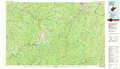 |
Elkins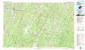 |
Charleston |
Marlinton |
Staunton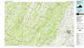 |
Beckley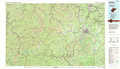 |
Lewisburg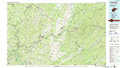 |
Buena Vista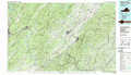 |
> Back to 38080a1 at 1:250,000 scale
> Back to U.S. Topo Maps home
1:24,000 Topo Quads covered by the spatial extent of this 100k map (Marlinton)
|
Swandale 
|
Widen 
|
Tioga 
|
Cowen 
|
Webster Springs 
|
Bergoo 
|
Sharp Knob 
|
Mingo 
|
|
Gilboa 
|
Summersville 
|
Craigsville 
|
Camden On Gauley 
|
Webster Springs Sw 
|
Webster Springs Se 
|
Woodrow 
|
Edray 
|
|
Summersville Dam 
|
Mount Nebo 
|
Nettie 
|
Richwood 
|
Fork Mountain 
|
Lobelia 
|
Hillsboro 
|
Marlinton 
|
|
Winona 
|
Corliss 
|
Quinwood 
|
Duo 
|
Trout 
|
Droop 
|
Denmar 
|
Lake Sherwood 
|
