Ripley Topo Map West Virginia
To zoom in, hover over the map of Ripley
USGS Topo Map 38081e1 - 1:100,000 scale
| Topo Map Name: | Ripley |
| USGS Topo Quad ID: | 38081e1 |
| Print Size: | ca. 39" wide x 24" high |
| Southeast Coordinates: | 38.5° N latitude / 81° W longitude |
| Map Center Coordinates: | 38.75° N latitude / 81.5° W longitude |
| U.S. States: | WV, OH |
| Filename: | 38081e1.jpg |
| Download Map JPG Image: | Ripley topo map 1:100,000 scale |
| Map Type: | Topographic |
| Topo Series: | 30´x60´ |
| Map Scale: | 1:100,000 |
| Source of Map Images: | United States Geological Survey (USGS) |
| Alternate Map Versions: |
Ripley WV 1984, updated 1984 Download PDF Buy paper map |
1:100,000 Topos surrounding Ripley
Wellston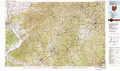 |
Parkersburg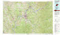 |
Clarksburg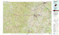 |
Ironton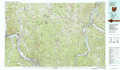 |
Ripley |
Sutton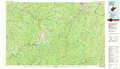 |
Huntington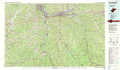 |
Charleston |
Marlinton |
> Back to 38080a1 at 1:250,000 scale
> Back to U.S. Topo Maps home
1:24,000 Topo Quads covered by the spatial extent of this 100k map (Ripley)
|
New Haven 
|
Ravenswood 
|
Sandyville 
|
Liverpool 
|
Reedy 
|
Burning Springs 
|
Annamoriah 
|
Grantsville 
|
|
Mount Alto 
|
Cottageville 
|
Ripley 
|
Gay 
|
Peniel 
|
Spencer 
|
Arnoldsburg 
|
Millstone 
|
|
Robertsburg 
|
Elmwood 
|
Kenna 
|
Kentuck 
|
Walton 
|
Looneyville 
|
Tariff 
|
Chloe 
|
|
Winfield 
|
Bancroft 
|
Sissonville 
|
Romance 
|
Kettle 
|
Clio 
|
Newton 
|
Ivydale 
|
