Saint Louis Topo Map Missouri
To zoom in, hover over the map of Saint Louis
USGS Topo Map 38090e1 - 1:100,000 scale
| Topo Map Name: | Saint Louis |
| USGS Topo Quad ID: | 38090e1 |
| Print Size: | ca. 39" wide x 24" high |
| Southeast Coordinates: | 38.5° N latitude / 90° W longitude |
| Map Center Coordinates: | 38.75° N latitude / 90.5° W longitude |
| U.S. States: | MO, IL |
| Filename: | 38090e1.jpg |
| Download Map JPG Image: | Saint Louis topo map 1:100,000 scale |
| Map Type: | Topographic |
| Topo Series: | 30´x60´ |
| Map Scale: | 1:100,000 |
| Source of Map Images: | United States Geological Survey (USGS) |
| Alternate Map Versions: |
St Louis MO 1985, updated 1985 Download PDF Buy paper map St Louis MO 1985, updated 1988 Download PDF Buy paper map St Louis MO 1985, updated 1988 Download PDF Buy paper map |
1:100,000 Topos surrounding Saint Louis
Mexico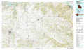 |
Jerseyville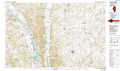 |
Litchfield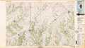 |
Fulton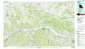 |
Saint Louis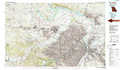 |
Carlyle Lake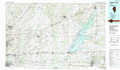 |
Sullivan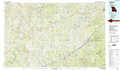 |
Festus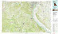 |
Pinckneyville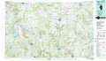 |
> Back to 38090a1 at 1:250,000 scale
> Back to U.S. Topo Maps home
1:24,000 Topo Quads covered by the spatial extent of this 100k map (Saint Louis)
|
Troy 
|
Maryknoll 
|
Winfield 
|
Brussels 
|
Grafton 
|
Elsah 
|
Alton 
|
Bethalto 
|
|
Foristell 
|
Wentzville 
|
O'Fallon 
|
Kampville 
|
Saint Charles 
|
Florissant 
|
Columbia Bottom 
|
Wood River 
|
|
New Melle 
|
Defiance 
|
Weldon Spring 
|
Chesterfield 
|
Creve Coeur 
|
Clayton 
|
Granite City 
|
Monks Mound 
|
|
Washington East 
|
Labadie 
|
Eureka 
|
Manchester 
|
Kirkwood 
|
Webster Groves 
|
Cahokia 
|
French Village 
|
