Richfield Topo Map Utah
To zoom in, hover over the map of Richfield
USGS Topo Map 38112e1 - 1:100,000 scale
| Topo Map Name: | Richfield |
| USGS Topo Quad ID: | 38112e1 |
| Print Size: | ca. 39" wide x 24" high |
| Southeast Coordinates: | 38.5° N latitude / 112° W longitude |
| Map Center Coordinates: | 38.75° N latitude / 112.5° W longitude |
| U.S. State: | UT |
| Filename: | 38112e1.jpg |
| Download Map JPG Image: | Richfield topo map 1:100,000 scale |
| Map Type: | Topographic |
| Topo Series: | 30´x60´ |
| Map Scale: | 1:100,000 |
| Source of Map Images: | United States Geological Survey (USGS) |
| Alternate Map Versions: |
Richfield UT 1980, updated 1987 Download PDF Buy paper map Richfield UT 1980, updated 1987 Download PDF Buy paper map |
1:100,000 Topos surrounding Richfield
Tule Valley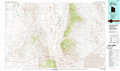 |
Delta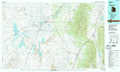 |
Manti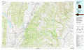 |
Wah Wah Mountains North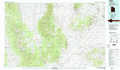 |
Richfield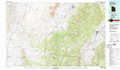 |
Salina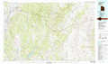 |
Wah Wah Mountains South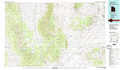 |
Beaver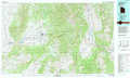 |
Loa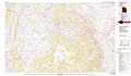 |
> Back to 38112a1 at 1:250,000 scale
> Back to U.S. Topo Maps home
1:24,000 Topo Quads covered by the spatial extent of this 100k map (Richfield)
|
Candland Spring 
|
Borden 
|
Sand Ridge 
|
Tabernacle Hill 
|
Meadow 
|
Fillmore 
|
Mount Catherine 
|
Beehive Peak 
|
|
Cat Canyon 
|
Cruz 
|
Black Point 
|
Sixmile Point 
|
Kanosh 
|
Sunset Peak 
|
White Pine Peak 
|
Richfield 
|
|
Black Rock 
|
Antelope Spring 
|
Antelope Valley 
|
Dog Valley Peak 
|
Red Ridge 
|
Joseph Peak 
|
Elsinore 
|
Annabella 
|
|
Read 
|
Pinnacle Pass 
|
Cinder Crater 
|
Cove Fort 
|
Trail Mountain 
|
Marysvale Canyon 
|
Antelope Range 
|
Monroe Peak 
|
