Indianapolis Topo Map Indiana
To zoom in, hover over the map of Indianapolis
USGS Topo Map 39086e1 - 1:100,000 scale
| Topo Map Name: | Indianapolis |
| USGS Topo Quad ID: | 39086e1 |
| Print Size: | ca. 39" wide x 24" high |
| Southeast Coordinates: | 39.5° N latitude / 86° W longitude |
| Map Center Coordinates: | 39.75° N latitude / 86.5° W longitude |
| U.S. State: | IN |
| Filename: | 39086e1.jpg |
| Download Map JPG Image: | Indianapolis topo map 1:100,000 scale |
| Map Type: | Topographic |
| Topo Series: | 30´x60´ |
| Map Scale: | 1:100,000 |
| Source of Map Images: | United States Geological Survey (USGS) |
| Alternate Map Versions: |
Indianapolis IN 1986, updated 1986 Download PDF Buy paper map Indianapolis IN 1986, updated 1989 Download PDF Buy paper map |
1:100,000 Topos surrounding Indianapolis
Danville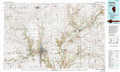 |
La Fayette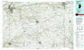 |
Muncie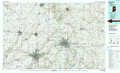 |
Paris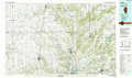 |
Indianapolis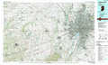 |
New Castle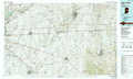 |
Terre Haute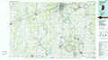 |
Bloomington |
Greensburg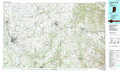 |
> Back to 39086a1 at 1:250,000 scale
> Back to U.S. Topo Maps home
1:24,000 Topo Quads covered by the spatial extent of this 100k map (Indianapolis)
|
New Market 
|
Ladoga 
|
New Ross 
|
Lizton 
|
Fayette 
|
Zionsville 
|
Carmel 
|
Fishers 
|
|
Russellville 
|
Roachdale 
|
North Salem 
|
Danville 
|
Brownsburg 
|
Clermont 
|
Indianapolis West 
|
Indianapolis East 
|
|
Clinton Falls 
|
Greencastle 
|
Coatesville 
|
Clayton 
|
Plainfield 
|
Bridgeport 
|
Maywood 
|
Beech Grove 
|
|
Reelsville 
|
Cloverdale 
|
Eminence 
|
Hall 
|
Mooresville West 
|
Mooresville East 
|
Bargersville 
|
Greenwood 
|
