Leadville Topo Map Colorado
To zoom in, hover over the map of Leadville
USGS Topo Map 39106a1 - 1:100,000 scale
| Topo Map Name: | Leadville |
| USGS Topo Quad ID: | 39106a1 |
| Print Size: | ca. 39" wide x 24" high |
| Southeast Coordinates: | 39° N latitude / 106° W longitude |
| Map Center Coordinates: | 39.25° N latitude / 106.5° W longitude |
| U.S. State: | CO |
| Filename: | 39106a1.jpg |
| Download Map JPG Image: | Leadville topo map 1:100,000 scale |
| Map Type: | Topographic |
| Topo Series: | 30´x60´ |
| Map Scale: | 1:100,000 |
| Source of Map Images: | United States Geological Survey (USGS) |
| Alternate Map Versions: |
Leadville CO 1983, updated 1983 Download PDF Buy paper map |
1:100,000 Topos surrounding Leadville
Glenwood Springs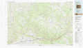 |
Vail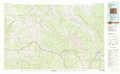 |
Denver West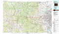 |
Carbondale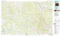 |
Leadville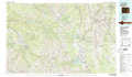 |
Bailey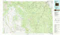 |
Paonia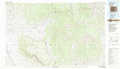 |
Gunnison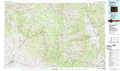 |
Pikes Peak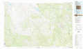 |
> Back to 39106a1 at 1:250,000 scale
> Back to U.S. Topo Maps home
1:24,000 Topo Quads covered by the spatial extent of this 100k map (Leadville)
|
Toner Reservoir 
|
Red Creek 
|
Crooked Creek Pass 
|
Mount Jackson 
|
Mount Of The Holy Cross 
|
Pando 
|
Copper Mountain 
|
Breckenridge 
|
|
Woody Creek 
|
Ruedi 
|
Meredith 
|
Nast 
|
Homestake Reservoir 
|
Leadville North 
|
Climax 
|
Alma 
|
|
Highland Peak 
|
Aspen 
|
Thimble Rock 
|
Mount Champion 
|
Mount Massive 
|
Leadville South 
|
Mount Sherman 
|
Fairplay West 
|
|
Maroon Bells 
|
Hayden Peak 
|
New York Peak 
|
Independence Pass 
|
Mount Elbert 
|
Granite 
|
South Peak 
|
Jones Hill 
|
