Lynndyl Topo Map Utah
To zoom in, hover over the map of Lynndyl
USGS Topo Map 39112e1 - 1:100,000 scale
| Topo Map Name: | Lynndyl |
| USGS Topo Quad ID: | 39112e1 |
| Print Size: | ca. 39" wide x 24" high |
| Southeast Coordinates: | 39.5° N latitude / 112° W longitude |
| Map Center Coordinates: | 39.75° N latitude / 112.5° W longitude |
| U.S. State: | UT |
| Filename: | 39112e1.jpg |
| Download Map JPG Image: | Lynndyl topo map 1:100,000 scale |
| Map Type: | Topographic |
| Topo Series: | 30´x60´ |
| Map Scale: | 1:100,000 |
| Source of Map Images: | United States Geological Survey (USGS) |
| Alternate Map Versions: |
Lynndyl UT 1979, updated 1979 Download PDF Buy paper map Lynndyl UT 1979, updated 1979 Download PDF Buy paper map |
1:100,000 Topos surrounding Lynndyl
Wildcat Mountain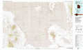 |
Rush Valley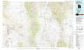 |
Provo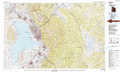 |
Fish Springs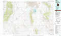 |
Lynndyl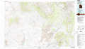 |
Nephi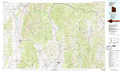 |
Tule Valley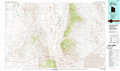 |
Delta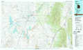 |
Manti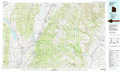 |
> Back to 39112a1 at 1:250,000 scale
> Back to U.S. Topo Maps home
1:24,000 Topo Quads covered by the spatial extent of this 100k map (Lynndyl)
|
Table Mountain 
|
Coyote Springs 
|
Indian Springs 
|
Erickson Knoll 
|
Dutch Peak 
|
Sabie Mountain 
|
Tintic Junction 
|
Eureka 
|
|
Keg Pass 
|
Keg Mountain Ranch 
|
Erickson Wash Sw 
|
Desert Mountain Pass 
|
Cherry Creek 
|
Maple Peak 
|
Mcintyre 
|
Tintic Mountain 
|
|
Picture Rock Hills 
|
The Hogback 
|
Crater Bench Reservoir 
|
Desert Mountain Reservoir 
|
Lynndyl Nw 
|
Tanner Creek Narrows 
|
Jericho 
|
Furner Ridge 
|
|
Drum Mountains Well 
|
Fumarole Butte 
|
Baker Hot Springs 
|
Rain Lake 
|
Lynndyl West 
|
Lynndyl East 
|
Champlin Peak 
|
Sage Valley 
|
