Fish Springs Topo Map Utah
To zoom in, hover over the map of Fish Springs
USGS Topo Map 39113e1 - 1:100,000 scale
| Topo Map Name: | Fish Springs |
| USGS Topo Quad ID: | 39113e1 |
| Print Size: | ca. 39" wide x 24" high |
| Southeast Coordinates: | 39.5° N latitude / 113° W longitude |
| Map Center Coordinates: | 39.75° N latitude / 113.5° W longitude |
| U.S. State: | UT |
| Filename: | 39113e1.jpg |
| Download Map JPG Image: | Fish Springs topo map 1:100,000 scale |
| Map Type: | Topographic |
| Topo Series: | 30´x60´ |
| Map Scale: | 1:100,000 |
| Source of Map Images: | United States Geological Survey (USGS) |
| Alternate Map Versions: |
Fish Springs UT 1979, updated 1979 Download PDF Buy paper map Fish Springs UT 1979, updated 1979 Download PDF Buy paper map Fish Springs UT 1979, updated 1991 Download PDF Buy paper map Fish Springs UT 1979, updated 1991 Download PDF Buy paper map |
1:100,000 Topos surrounding Fish Springs
Currie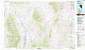 |
Wildcat Mountain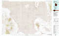 |
Rush Valley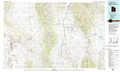 |
Kern Mountains |
Fish Springs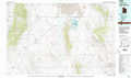 |
Lynndyl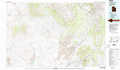 |
Ely |
Tule Valley |
Delta |
> Back to 39112a1 at 1:250,000 scale
> Back to U.S. Topo Maps home
1:24,000 Topo Quads covered by the spatial extent of this 100k map (Fish Springs)
|
Goshute 
|
Goshute Canyon 
|
Callao 
|
Callao Ne 
|
Fish Springs Nw 
|
Fish Springs Ne 
|
Dugway Range Nw 
|
Dugway Range Ne 
|
|
Ibapah Peak 
|
Indian Farm Creek 
|
Mud Lake Reservoir 
|
Boyd Station 
|
Fish Springs Sw 
|
Fish Springs Se 
|
Dugway Range Sw 
|
Dugway Pass 
|
|
Partoun 
|
Trout Creek 
|
Hole-In-The-Wall Reservoir 
|
Middle Range North 
|
Sand Pass Nw 
|
Sand Pass Ne 
|
Topaz Mountain West 
|
Topaz Mountain East 
|
|
Trout Creek Sw 
|
Cockscomb Ridge 
|
Granite Mountain 
|
Middle Range South 
|
Sand Pass 
|
Sand Pass Se 
|
Topaz Mountain Sw 
|
Lady Laird Peak 
|
