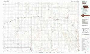
Imperial Topo Map Nebraska

To zoom in, hover over the map of Imperial

USGS Topo Map 40101e1 - 1:100,000 scale

Topo Map Name: Imperial
USGS Topo Quad ID: 40101e1
Print Size: ca. 39" wide x 24" high
Southeast Coordinates: 40.5° N latitude / 101° W longitude
Map Center Coordinates: 40.75° N latitude / 101.5° W longitude
U.S. State: NE
Filename: 40101e1.jpg
Download Map JPG Image: Imperial topo map 1:100,000 scale
Map Type: Topographic
Topo Series: 30´x60´
Map Scale: 1:100,000
Source of Map Images: United States Geological Survey (USGS)
Alternate Map Versions: Imperial NE 1979, updated 1979 Download PDF Buy paper map

1:100,000 Topos surrounding Imperial

Chappell
Chappell USGS topographic map 41102a1
Ogallala
Ogallala USGS topographic map 41101a1
North Platte
North Platte USGS topographic map 41100a1
Julesburg
Julesburg USGS topographic map 40102e1
Imperial
Imperial USGS topographic map 40101e1
Gothenburg
Gothenburg USGS topographic map 40100e1
Wray
Wray USGS topographic map 40102a1
Benkelman
Benkelman USGS topographic map 40101a1
Mc Cook
Mc Cook USGS topographic map 40100a1

> Back to 40100a1 at 1:250,000 scale
> Back to U.S. Topo Maps home

1:24,000 Topo Quads covered by the spatial extent of this 100k map (Imperial)

Brandon Nw
Brandon Nw USGS topographic map 40101h8
Brandon Ne
Brandon Ne USGS topographic map 40101h7
Wild Horse Spring
Wild Horse Spring USGS topographic map 40101h6
Grant Ne
Grant Ne USGS topographic map 40101h5
Elsie Nw
Elsie Nw USGS topographic map 40101h4
Elsie Ne
Elsie Ne USGS topographic map 40101h3
Wallace Nw
Wallace Nw USGS topographic map 40101h2
Wallace Ne
Wallace Ne USGS topographic map 40101h1
Brandon
Brandon USGS topographic map 40101g8
Brandon Se
Brandon Se USGS topographic map 40101g7
Grant
Grant USGS topographic map 40101g6
Madrid
Madrid USGS topographic map 40101g5
Elsie
Elsie USGS topographic map 40101g4
Grainton
Grainton USGS topographic map 40101g3
Wallace
Wallace USGS topographic map 40101g2
Melton Ranch Airport
Melton Ranch Airport USGS topographic map 40101g1
Lamar Nw
Lamar Nw USGS topographic map 40101f8
Lamar Ne
Lamar Ne USGS topographic map 40101f7
Imperial Nw
Imperial Nw USGS topographic map 40101f6
Imperial Ne
Imperial Ne USGS topographic map 40101f5
Dittons Creek Nw
Dittons Creek Nw USGS topographic map 40101f4
Dittons Creek Ne
Dittons Creek Ne USGS topographic map 40101f3
Hayes Center Nw
Hayes Center Nw USGS topographic map 40101f2
Suttlers Canyon West
Suttlers Canyon West USGS topographic map 40101f1
Lamar
Lamar USGS topographic map 40101e8
Chase
Chase USGS topographic map 40101e7
Imperial
Imperial USGS topographic map 40101e6
Imperial Muni Airport
Imperial Muni Airport USGS topographic map 40101e5
Dittons Creek
Dittons Creek USGS topographic map 40101e4
Dittons Creek Se
Dittons Creek Se USGS topographic map 40101e3
Hayes Center Sw
Hayes Center Sw USGS topographic map 40101e2
Hayes Center
Hayes Center USGS topographic map 40101e1
Imperial topographical map