Clearfield Topo Map Pennsylvania
To zoom in, hover over the map of Clearfield
USGS Topo Map 41078a1 - 1:100,000 scale
| Topo Map Name: | Clearfield |
| USGS Topo Quad ID: | 41078a1 |
| Print Size: | ca. 39" wide x 24" high |
| Southeast Coordinates: | 41° N latitude / 78° W longitude |
| Map Center Coordinates: | 41.25° N latitude / 78.5° W longitude |
| U.S. State: | PA |
| Filename: | 41078a1.jpg |
| Download Map JPG Image: | Clearfield topo map 1:100,000 scale |
| Map Type: | Topographic |
| Topo Series: | 30´x60´ |
| Map Scale: | 1:100,000 |
| Source of Map Images: | United States Geological Survey (USGS) |
| Alternate Map Versions: |
Clearfield PA 1983, updated 1984 Download PDF Buy paper map |
1:100,000 Topos surrounding Clearfield
Warren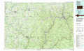 |
Bradford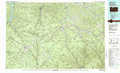 |
Wellsboro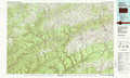 |
Oil City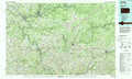 |
Clearfield |
Williamsport West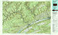 |
Indiana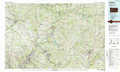 |
Tyrone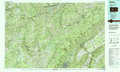 |
State College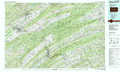 |
> Back to 41078a1 at 1:250,000 scale
> Back to U.S. Topo Maps home
1:24,000 Topo Quads covered by the spatial extent of this 100k map (Clearfield)
|
Hallton 
|
Portland Mills 
|
Ridgway 
|
Saint Marys 
|
Rathbun 
|
West Creek 
|
Cameron 
|
First Fork 
|
|
Munderf 
|
Carman 
|
Brandy Camp 
|
Kersey 
|
Weedville 
|
Dents Run 
|
Driftwood 
|
Sinnemahoning 
|
|
Hazen 
|
Falls Creek 
|
Sabula 
|
Penfield 
|
Huntley 
|
The Knobs 
|
Devils Elbow 
|
Pottersdale 
|
|
Reynoldsville 
|
Du Bois 
|
Luthersburg 
|
Elliott Park 
|
Clearfield 
|
Lecontes Mills 
|
Frenchville 
|
Karthaus 
|
