High Rock Canyon Topo Map Nevada
To zoom in, hover over the map of High Rock Canyon
USGS Topo Map 41119a1 - 1:100,000 scale
| Topo Map Name: | High Rock Canyon |
| USGS Topo Quad ID: | 41119a1 |
| Print Size: | ca. 39" wide x 24" high |
| Southeast Coordinates: | 41° N latitude / 119° W longitude |
| Map Center Coordinates: | 41.25° N latitude / 119.5° W longitude |
| U.S. States: | NV, CA |
| Filename: | 41119a1.jpg |
| Download Map JPG Image: | High Rock Canyon topo map 1:100,000 scale |
| Map Type: | Topographic |
| Topo Series: | 30´x60´ |
| Map Scale: | 1:100,000 |
| Source of Map Images: | United States Geological Survey (USGS) |
| Alternate Map Versions: |
High Rock Canyon NV 1981, updated 1981 Download PDF Buy paper map High Rock Canyon NV 1981, updated 1981 Download PDF Buy paper map |
1:100,000 Topos surrounding High Rock Canyon
Cedarville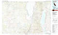 |
Vya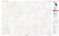 |
Denio |
Alturas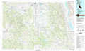 |
High Rock Canyon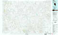 |
Jackson Mountains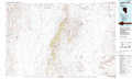 |
Eagle Lake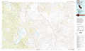 |
Gerlach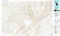 |
Eugene Mountains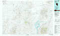 |
> Back to 41118a1 at 1:250,000 scale
> Back to U.S. Topo Maps home
1:24,000 Topo Quads covered by the spatial extent of this 100k map (High Rock Canyon)
|
Big Hat Mountain 
|
Boulder Lake 
|
Powers Well 
|
Nellie Spring Mountain 
|
Yellow Hills West 
|
Yellow Hills East 
|
Soldier Meadow 
|
Red Mountain 
|
|
Hays Canyon 
|
Boulder Mountain 
|
Pinto Springs 
|
Hart Mountain 
|
Mahogany Mountain 
|
High Rock Lake 
|
Mud Meadow 
|
Big Mountain 
|
|
Pegleg Canyon 
|
Wall Canyon Reservoir 
|
Bordwell Spring 
|
Chester Lyons Spring 
|
Butte Spring 
|
Mcconnel Canyon 
|
Wagner Springs 
|
Clapper Creek 
|
|
Duck Lake 
|
Juniper Springs 
|
Lost Creek Pass 
|
Fox Mountain 
|
Leadville 
|
Division Peak 
|
Donnelly Creek 
|
Double Hot Springs 
|
