Oelwein Topo Map Iowa
To zoom in, hover over the map of Oelwein
USGS Topo Map 42091e1 - 1:100,000 scale
| Topo Map Name: | Oelwein |
| USGS Topo Quad ID: | 42091e1 |
| Print Size: | ca. 39" wide x 24" high |
| Southeast Coordinates: | 42.5° N latitude / 91° W longitude |
| Map Center Coordinates: | 42.75° N latitude / 91.5° W longitude |
| U.S. States: | IA, WI |
| Filename: | 42091e1.jpg |
| Download Map JPG Image: | Oelwein topo map 1:100,000 scale |
| Map Type: | Topographic |
| Topo Series: | 30´x60´ |
| Map Scale: | 1:100,000 |
| Source of Map Images: | United States Geological Survey (USGS) |
| Alternate Map Versions: |
Oelwein IA 1984, updated 1985 Download PDF Buy paper map Oelwein IA 1984, updated 1989 Download PDF Buy paper map |
1:100,000 Topos surrounding Oelwein
Charles City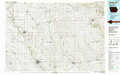 |
Decorah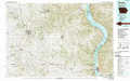 |
Richland Center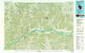 |
Waverly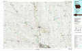 |
Oelwein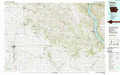 |
Dubuque North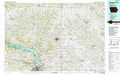 |
Marshalltown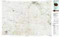 |
Anamosa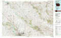 |
Dubuque South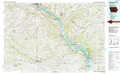 |
> Back to 42090a1 at 1:250,000 scale
> Back to U.S. Topo Maps home
1:24,000 Topo Quads covered by the spatial extent of this 100k map (Oelwein)
|
Hawkeye 
|
West Union 
|
Elgin 
|
Gunder 
|
Saint Olaf 
|
Farmersburg 
|
Clayton 
|
Bagley 
|
|
Maynard 
|
Fayette 
|
Wadena 
|
Volga 
|
Elkader 
|
Littleport 
|
Garnavillo 
|
Guttenberg 
|
|
Oelwein 
|
Stanley 
|
Arlington 
|
Strawberry Point 
|
Edgewood 
|
Garber 
|
Colesburg 
|
Turkey River 
|
|
Hazleton 
|
Oelwein Se 
|
Lamont 
|
Dundee 
|
Thorpe 
|
Greeley 
|
Petersburg 
|
New Vienna 
|
