Stephenson Mountain Topo Map Oregon
To zoom in, hover over the map of Stephenson Mountain
USGS Topo Map 44120e1 - 1:100,000 scale
| Topo Map Name: | Stephenson Mountain |
| USGS Topo Quad ID: | 44120e1 |
| Print Size: | ca. 39" wide x 24" high |
| Southeast Coordinates: | 44.5° N latitude / 120° W longitude |
| Map Center Coordinates: | 44.75° N latitude / 120.5° W longitude |
| U.S. State: | OR |
| Filename: | 44120e1.jpg |
| Download Map JPG Image: | Stephenson Mountain topo map 1:100,000 scale |
| Map Type: | Topographic |
| Topo Series: | 30´x60´ |
| Map Scale: | 1:100,000 |
| Source of Map Images: | United States Geological Survey (USGS) |
| Alternate Map Versions: |
Stephenson Mountain OR 1981, updated 1997 Download PDF Buy paper map |
1:100,000 Topos surrounding Stephenson Mountain
Mount Hood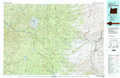 |
Condon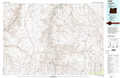 |
Heppner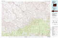 |
Madras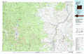 |
Stephenson Mountain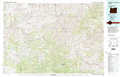 |
Monument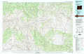 |
Bend |
Prineville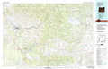 |
Dayville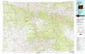 |
> Back to 44120a1 at 1:250,000 scale
> Back to U.S. Topo Maps home
1:24,000 Topo Quads covered by the spatial extent of this 100k map (Stephenson Mountain)
|
Shaniko Junction 
|
Shaniko Summit 
|
Antelope 
|
Hastings Peak 
|
Clarno 
|
Porcupine Butte 
|
Fossil South 
|
Kinzua 
|
|
Willowdale 
|
Degner Canyon 
|
Donnybrook 
|
Arrastra Butte 
|
Muddy Ranch 
|
Jennies Peak 
|
Rowe Creek 
|
Service Creek 
|
|
Teller Butte 
|
Ashwood 
|
Axehandle Butte 
|
Horse Heaven Creek 
|
Sandrock Mountain 
|
Painted Hills 
|
Sutton Mountain 
|
Toney Butte 
|
|
Brewer Reservoir 
|
Foley Butte 
|
Dutchman Creek 
|
Opal Mountain 
|
Stephenson Mountain 
|
Lawson Mountain 
|
Mitchell 
|
Keyes Mountain 
|
