Lake Minnewaska Topo Map Minnesota
To zoom in, hover over the map of Lake Minnewaska
USGS Topo Map 45095e1 - 1:100,000 scale
| Topo Map Name: | Lake Minnewaska |
| USGS Topo Quad ID: | 45095e1 |
| Print Size: | ca. 39" wide x 24" high |
| Southeast Coordinates: | 45.5° N latitude / 95° W longitude |
| Map Center Coordinates: | 45.75° N latitude / 95.5° W longitude |
| U.S. State: | MN |
| Filename: | 45095e1.jpg |
| Download Map JPG Image: | Lake Minnewaska topo map 1:100,000 scale |
| Map Type: | Topographic |
| Topo Series: | 30´x60´ |
| Map Scale: | 1:100,000 |
| Source of Map Images: | United States Geological Survey (USGS) |
| Alternate Map Versions: |
Lake Minnewaska MN 1986, updated 1986 Download PDF Buy paper map Lake Minnewaska MN 1986, updated 1990 Download PDF Buy paper map |
1:100,000 Topos surrounding Lake Minnewaska
Wahpeton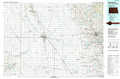 |
Battle Lake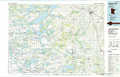 |
Brainerd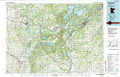 |
Wheaton |
Lake Minnewaska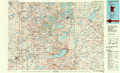 |
Saint Cloud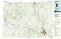 |
Milbank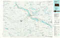 |
Willmar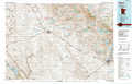 |
Litchfield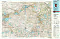 |
> Back to 45094a1 at 1:250,000 scale
> Back to U.S. Topo Maps home
1:24,000 Topo Quads covered by the spatial extent of this 100k map (Lake Minnewaska)
|
Elbow Lake 
|
Erdahl 
|
Quam Lake 
|
Brandon 
|
Alexandria West 
|
Alexandria East 
|
Lake Osakis West 
|
Lake Osakis East 
|
|
Patchen Lake 
|
Hoffman 
|
Kensington 
|
Farwell 
|
Lake Mary 
|
Forada 
|
Osakis 
|
West Union 
|
|
Wintermute Lake 
|
Pomme De Terre Lakes 
|
Starbuck Nw 
|
Lowry 
|
Glenwood 
|
Villard 
|
Westport 
|
Raymond Lake 
|
|
Morris 
|
Page Lake 
|
Cyrus 
|
Starbuck 
|
Lake Minnewaska 
|
Terrace 
|
Sedan 
|
Padua 
|
