Cass Lake Topo Map Minnesota
To zoom in, hover over the map of Cass Lake
USGS Topo Map 47094a1 - 1:100,000 scale
| Topo Map Name: | Cass Lake |
| USGS Topo Quad ID: | 47094a1 |
| Print Size: | ca. 39" wide x 24" high |
| Southeast Coordinates: | 47° N latitude / 94° W longitude |
| Map Center Coordinates: | 47.25° N latitude / 94.5° W longitude |
| U.S. State: | MN |
| Filename: | 47094a1.jpg |
| Download Map JPG Image: | Cass Lake topo map 1:100,000 scale |
| Map Type: | Topographic |
| Topo Series: | 30´x60´ |
| Map Scale: | 1:100,000 |
| Source of Map Images: | United States Geological Survey (USGS) |
| Alternate Map Versions: |
Cass Lake MN 1977, updated 1978 Download PDF Buy paper map |
1:100,000 Topos surrounding Cass Lake
Fosston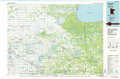 |
Blackduck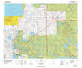 |
Bigfork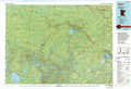 |
Lake Itasca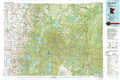 |
Cass Lake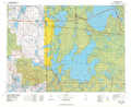 |
Pokegama Lake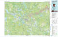 |
Detroit Lakes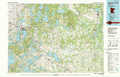 |
Pine River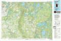 |
Aitkin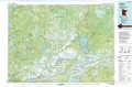 |
> Back to 47094a1 at 1:250,000 scale
> Back to U.S. Topo Maps home
1:24,000 Topo Quads covered by the spatial extent of this 100k map (Cass Lake)
|
Bemidji West 
|
Bemidji East 
|
Andrusia Lake 
|
Cass Lake 
|
Pennington 
|
Raven Lake 
|
Bena Nw 
|
Little Winnibigoshish Lake 
|
|
Frontenac Lake 
|
Guthrie 
|
Steamboat Lake 
|
Pike Bay 
|
Sucker Lakes 
|
Portage Lake 
|
Bena 
|
Nushka Lake 
|
|
Lake George 
|
Laporte 
|
Benedict 
|
Steamboat Bay 
|
Ottertail Point 
|
Sugar Point 
|
Federal Dam 
|
Boy River 
|
|
Mantrap Lake 
|
East Crooked Lake 
|
Akeley 
|
Walker 
|
Jack Lake 
|
Whipholt 
|
Town Line Lake 
|
Tobique 
|
