Lewistown Topo Map Montana
To zoom in, hover over the map of Lewistown
USGS Topo Map 47109a1 - 1:100,000 scale
| Topo Map Name: | Lewistown |
| USGS Topo Quad ID: | 47109a1 |
| Print Size: | ca. 39" wide x 24" high |
| Southeast Coordinates: | 47° N latitude / 109° W longitude |
| Map Center Coordinates: | 47.25° N latitude / 109.5° W longitude |
| U.S. State: | MT |
| Filename: | 47109a1.jpg |
| Download Map JPG Image: | Lewistown topo map 1:100,000 scale |
| Map Type: | Topographic |
| Topo Series: | 30´x60´ |
| Map Scale: | 1:100,000 |
| Source of Map Images: | United States Geological Survey (USGS) |
| Alternate Map Versions: |
Lewistown MT 1978, updated 1994 Download PDF Buy paper map |
1:100,000 Topos surrounding Lewistown
Fort Benton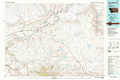 |
Winifred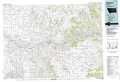 |
Zortman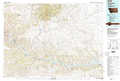 |
Belt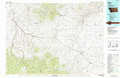 |
Lewistown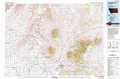 |
Winnett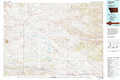 |
White Sulphur Springs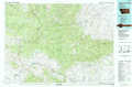 |
Big Snowy Mountains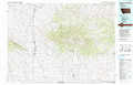 |
Musselshell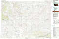 |
> Back to 47108a1 at 1:250,000 scale
> Back to U.S. Topo Maps home
1:24,000 Topo Quads covered by the spatial extent of this 100k map (Lewistown)
|
Possum Run Creek 
|
Soda Spring Coulee 
|
Wild Bill Flat West 
|
Wild Bill Flat East 
|
Hilger Nw 
|
Christina 
|
The Horse Ranch 
|
Fergus Ne 
|
|
Denton 
|
Hoosac 
|
Toney Bench 
|
Seventytwo Hills 
|
Kendall 
|
Hilger 
|
Armells 
|
Fergus 
|
|
Big Spring 
|
Harwood Bench 
|
Danvers 
|
Spring Creek Junction 
|
Brooks 
|
New Year 
|
Judith Peak 
|
Lewis Peak 
|
|
Moccasin 
|
Kolin 
|
Ross Fork 
|
Glengarry 
|
Lewistown 
|
Pike Creek 
|
Horsethief Coulee W. 
|
Horsethief Coulee E. 
|
