Plains Topo Map Montana
To zoom in, hover over the map of Plains
USGS Topo Map 47114a1 - 1:100,000 scale
| Topo Map Name: | Plains |
| USGS Topo Quad ID: | 47114a1 |
| Print Size: | ca. 39" wide x 24" high |
| Southeast Coordinates: | 47° N latitude / 114° W longitude |
| Map Center Coordinates: | 47.25° N latitude / 114.5° W longitude |
| U.S. State: | MT |
| Filename: | 47114a1.jpg |
| Download Map JPG Image: | Plains topo map 1:100,000 scale |
| Map Type: | Topographic |
| Topo Series: | 30´x60´ |
| Map Scale: | 1:100,000 |
| Source of Map Images: | United States Geological Survey (USGS) |
| Alternate Map Versions: | none available in database |
1:100,000 Topos surrounding Plains
Thompson Falls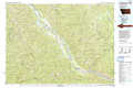 |
Polson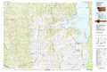 |
Swan Peak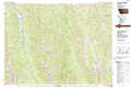 |
Wallace |
Plains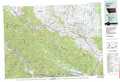 |
Seeley Lake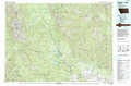 |
Headquarters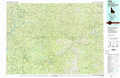 |
Missoula West |
Missoula East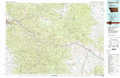 |
> Back to 47114a1 at 1:250,000 scale
> Back to U.S. Topo Maps home
1:24,000 Topo Quads covered by the spatial extent of this 100k map (Plains)
|
Plains 
|
Paradise 
|
Sunrise Spring 
|
Camas Prairie 
|
Melton Ranch 
|
Sloan 
|
Charlo 
|
Fort Connah 
|
|
Keystone Peak 
|
Quinns Hot Springs 
|
Knowles 
|
Perma 
|
Mcdonald 
|
Dixon 
|
Ravalli 
|
Saint Ignatius 
|
|
Superior 
|
Idaho Gulch 
|
Horsehead Peak 
|
Stark North 
|
Mccormick Peak 
|
Hewolf Mountain 
|
Saddle Mountain 
|
Arlee 
|
|
Landowner Mountain 
|
Lozeau 
|
Tarkio 
|
Stark South 
|
Alberton 
|
Huson 
|
Frenchtown 
|
Evaro 
|
