Coulee Dam Topo Map Washington
To zoom in, hover over the map of Coulee Dam
USGS Topo Map 47118e1 - 1:100,000 scale
| Topo Map Name: | Coulee Dam |
| USGS Topo Quad ID: | 47118e1 |
| Print Size: | ca. 39" wide x 24" high |
| Southeast Coordinates: | 47.5° N latitude / 118° W longitude |
| Map Center Coordinates: | 47.75° N latitude / 118.5° W longitude |
| U.S. State: | WA |
| Filename: | 47118e1.jpg |
| Download Map JPG Image: | Coulee Dam topo map 1:100,000 scale |
| Map Type: | Topographic |
| Topo Series: | 30´x60´ |
| Map Scale: | 1:100,000 |
| Source of Map Images: | United States Geological Survey (USGS) |
| Alternate Map Versions: |
Coulee Dam WA 1983, updated 1983 Download PDF Buy paper map Coulee Dam WA 1983, updated 1983 Download PDF Buy paper map |
1:100,000 Topos surrounding Coulee Dam
Omak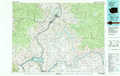 |
Nespelem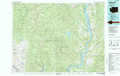 |
Chewelah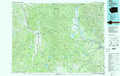 |
Banks Lake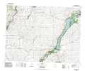 |
Coulee Dam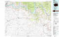 |
Spokane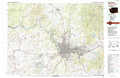 |
Moses Lake |
Ritzville |
Rosalia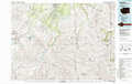 |
> Back to 47118a1 at 1:250,000 scale
> Back to U.S. Topo Maps home
1:24,000 Topo Quads covered by the spatial extent of this 100k map (Coulee Dam)
|
Grand Coulee Dam 
|
Mica Mountain 
|
Keller Ferry 
|
Whitestone Rock 
|
Johnny George Mountain 
|
Fort Spokane 
|
Mccoy Lake 
|
Turtle Lake 
|
|
Jack Woods Butte 
|
Broadax Draw 
|
Wilbur 
|
Creston 
|
Lincoln 
|
Olsen Canyon 
|
Inkster Lake 
|
Benjamin Lake 
|
|
Almira 
|
Govan 
|
Wagner Lake 
|
Creston Butte 
|
Telford 
|
Rocklyn 
|
Davenport 
|
Mondovi 
|
|
Almira Sw 
|
Almira Se 
|
Draper Lake 
|
Swanson Lakes 
|
Rocklyn Sw 
|
Rocklyn Se 
|
Bluestem 
|
Omans 
|
