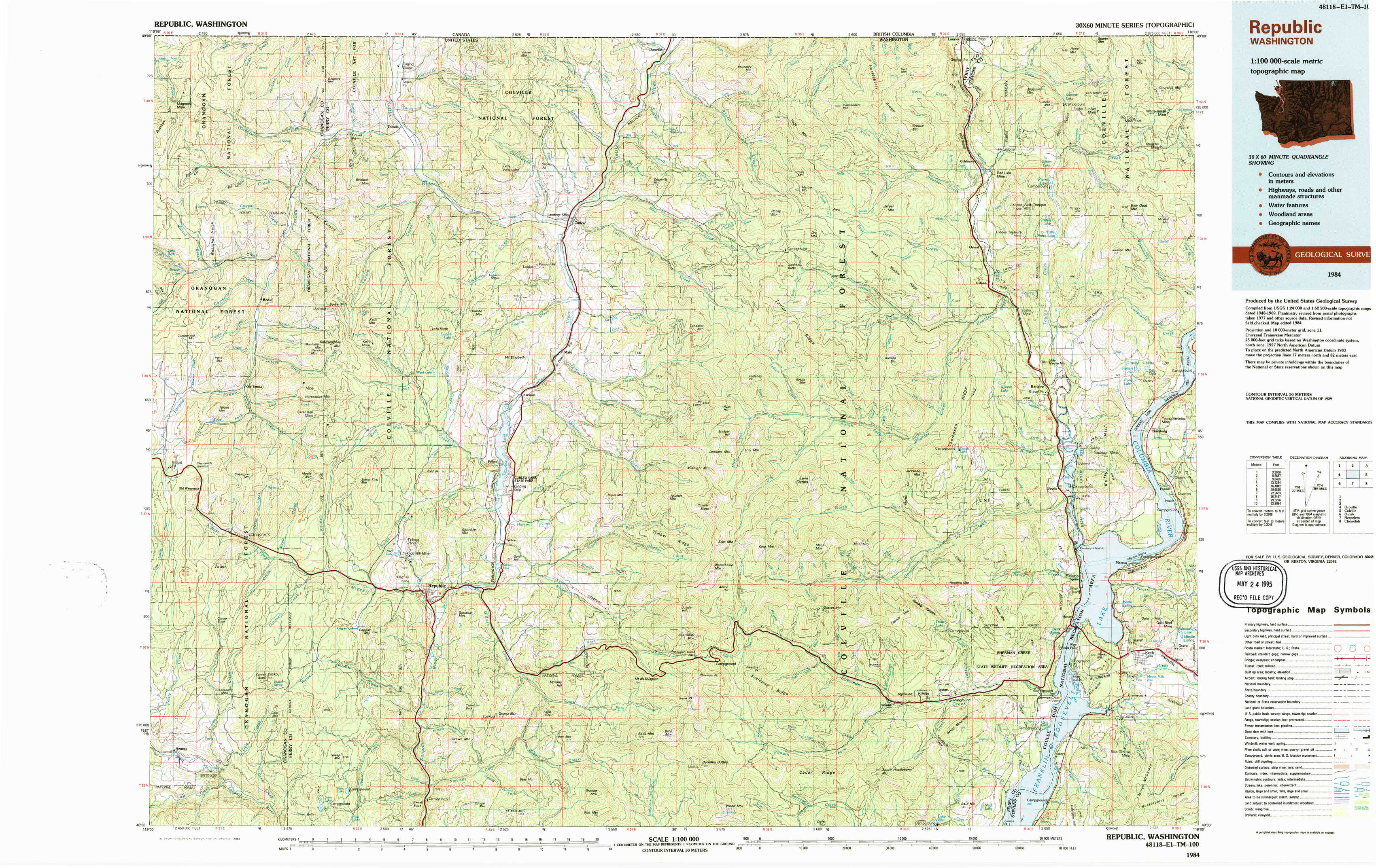
Republic Topo Map Washington
To zoom in, hover over the map of Republic
USGS Topo Map 48118e1 - 1:100,000 scale
| Topo Map Name: | Republic |
| USGS Topo Quad ID: | 48118e1 |
| Print Size: | ca. 39" wide x 24" high |
| Southeast Coordinates: | 48.5° N latitude / 118° W longitude |
| Map Center Coordinates: | 48.75° N latitude / 118.5° W longitude |
| U.S. State: | WA |
| Filename: | 48118e1.jpg |
| Download Map JPG Image: | Republic topo map 1:100,000 scale |
| Map Type: | Topographic |
| Topo Series: | 30´x60´ |
| Map Scale: | 1:100,000 |
| Source of Map Images: | United States Geological Survey (USGS) |
| Alternate Map Versions: |
Republic WA 1984, updated 1984 Download PDF Buy paper map |
1:100,000 Topos surrounding Republic
Oroville |
Republic |
Colville |
Omak |
Nespelem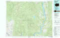 |
Chewelah |
> Back to 48118a1 at 1:250,000 scale
> Back to U.S. Topo Maps home
1:24,000 Topo Quads covered by the spatial extent of this 100k map (Republic)
|
Buckhorn Mountain 
|
Toroda 
|
Vulcan Mountain 
|
Curlew 
|
Boundary Mountain 
|
Independent Mountain 
|
Laurier 
|
Churchill Mountain 
|
|
Bodie 
|
Bodie Mountain 
|
Karamin 
|
Malo 
|
Mount Leona 
|
Bulldog Mountain 
|
Orient 
|
Bossburg 
|
|
Wauconda Summit 
|
Storm King Mountain 
|
Republic 
|
Cooke Mountain 
|
Copper Butte 
|
Jackknife Mountain 
|
Boyds 
|
Marcus 
|
|
Aeneas 
|
Swan Lake 
|
Bear Mountain 
|
Edds Mountain 
|
Sherman Peak 
|
South Huckleberry Mountain 
|
Bangs Mountain 
|
Kettle Falls 
|