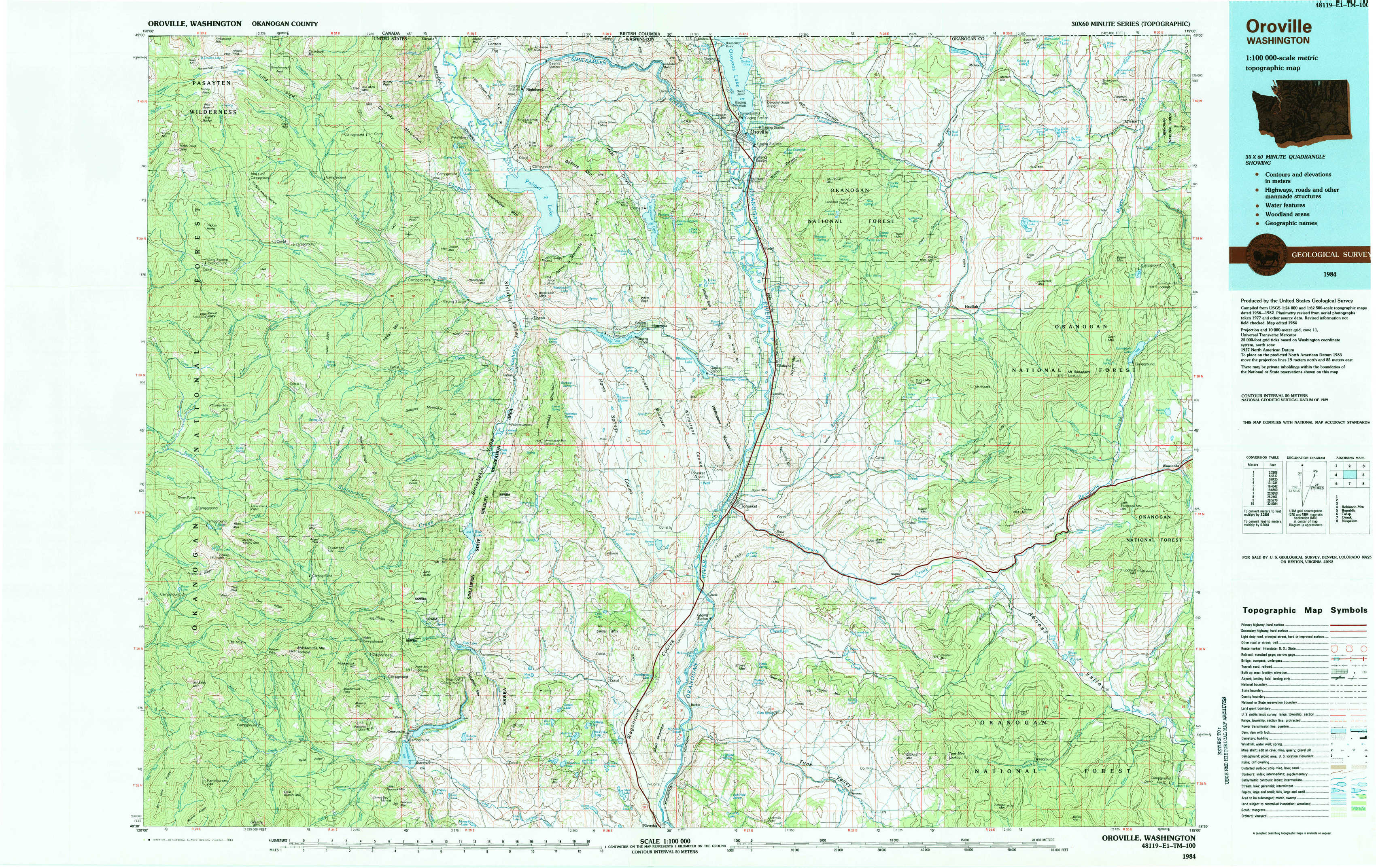
Oroville Topo Map Washington
To zoom in, hover over the map of Oroville
USGS Topo Map 48119e1 - 1:100,000 scale
| Topo Map Name: | Oroville |
| USGS Topo Quad ID: | 48119e1 |
| Print Size: | ca. 39" wide x 24" high |
| Southeast Coordinates: | 48.5° N latitude / 119° W longitude |
| Map Center Coordinates: | 48.75° N latitude / 119.5° W longitude |
| U.S. State: | WA |
| Filename: | 48119e1.jpg |
| Download Map JPG Image: | Oroville topo map 1:100,000 scale |
| Map Type: | Topographic |
| Topo Series: | 30´x60´ |
| Map Scale: | 1:100,000 |
| Source of Map Images: | United States Geological Survey (USGS) |
| Alternate Map Versions: |
Oroville WA 1984, updated 1984 Download PDF Buy paper map |
1:100,000 Topos surrounding Oroville
Robinson Mountain |
Oroville |
Republic |
Twisp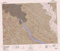 |
Omak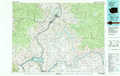 |
Nespelem |
> Back to 48118a1 at 1:250,000 scale
> Back to U.S. Topo Maps home
1:24,000 Topo Quads covered by the spatial extent of this 100k map (Oroville)
|
Horseshoe Basin 
|
Hurley Peak 
|
Nighthawk 
|
Bullfrog Mountain 
|
Oroville 
|
Mount Hull 
|
Molson 
|
Chesaw 
|
|
Corral Butte 
|
Duncan Ridge 
|
Loomis 
|
Enterprise 
|
Ellisforde 
|
Burge Mountain 
|
Havillah 
|
Mount Bonaparte 
|
|
Tiffany Mountain 
|
Coxit Mountain 
|
Blue Goat Mountain 
|
Aeneas Lake 
|
Tonasket 
|
Barker Mountain 
|
Cayuse Mountain 
|
Mount Annie 
|
|
Old Baldy 
|
Conconully West 
|
Conconully East 
|
Riverside 
|
Keystone 
|
Synarep 
|
Tunk Mountain 
|
Bailey Creek 
|